Context and objectives
![]()
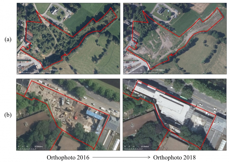
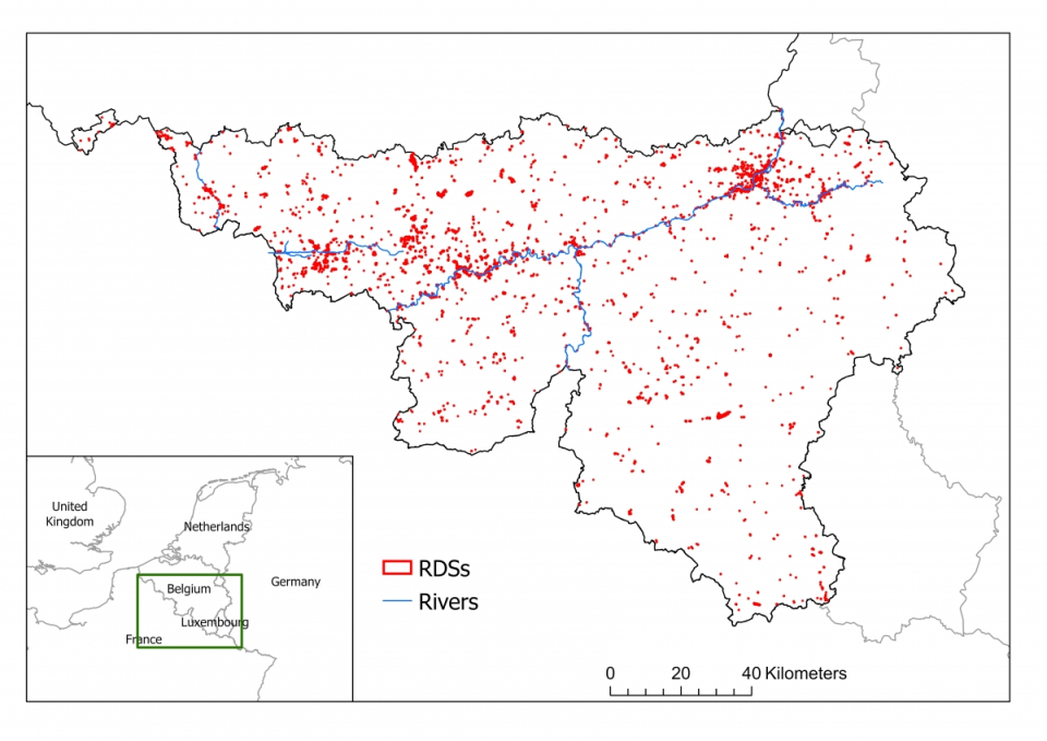
The Walloon Region is managing an inventory of more than 2,200 abandoned sites, called “Redevelopment sites” (RDS), which are former industrial, commercial, social, real estate (housing excluded) areas. While the presence of this type of site has a negative impact on the urban fabric, it also represents an opportunity for sustainable urban planning. It is therefore necessary for the Walloon Region to provide up-to-date information about the sites that have been regenerated and those that are still in disuse. The full update of this inventory, with its 2,200 sites spread all over the country, is costly and time consuming, but is essential to provide updated information to the different actors involved and to avoid leaving old RDSs in the database, which is accessible to the public.
At the moment, the inventory is mainly updated through on field campaigns and/or manually analysis of aerial orthophotos. Since less than 10% of the sites are estimated to change from one year to the next, it is important to ensure that field visits are prioritized according to actual needs in order to optimize available resources.
The aim of SARSAR was to develop a tool for automatic, near-real-time monitoring of the RDSs using Sentinel-1 synthetic aperture radar (SAR) and Sentinel-2 optical images, from the European Copernicus programme, in order to detect and classify changes that can then be confirmed and refined by on-site visit.
Project outcome
Scientific results
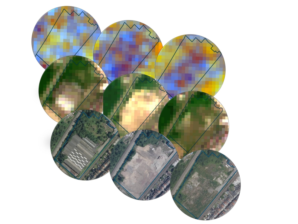
- A framework based on a first filter to remove unusable data (e.g. cloudy optical images), features extraction and creation of temporal profiles;
- A change detection methodology;
- A rule-based classifier to categorize changes into different types of land cover (vegetation, building and soil), also providing information on the direction of the change (increase, decrease), the amplitude and a confidence index;
- A computer environment, on Terrascope, for the processes automation.
Societal (including environmental) relevance
The SARSAR project has produced priority lists of the RDSs to be investigated on the field by the Walloon Region. Through this project, the Walloon administration was able to experience the benefits of using earth observation data in their day-to-day work. They were also trained to use the tool and the results provided. The first results have already been integrated to prioritize the manual analysis of aerial orthophotos and subsequently field verification.
The results of the project will soon be integrated into a visualization platform that will allow for a geographic overview of the sites to be prioritized.
Products and services
The lists of the RDS with the results of the change detection and classification are provided automatically by email. They are sent every two months for the preliminary results and once per year for the complete results.
Potential users
Beside the Walloon administration and the different actors involved in the RDSs management, the methodology developed in SARSAR could be use in various applications as it offers many advantages such as significant fieldwork reduction, regular area monitoring, detection of spots with significant changes …
Outreach
SARSAR: Sentinel data for urban planning and land management
SARSAR: les données Sentinel au service de la planification urbaine et de la gestion du territoire
| Project leader(s): | SPW - DG opérationnelle Aménagement du territoire, Logement, Patrimoine et Energie | |||||
| Belgian partner(s) |
|
|||||
| Location: |
Country:
Region:
|
|||||
| Related publications: | ||||||
| Website: | https://sarsar.issep.be | |||||