Tijdens de opeenvolgende STEREO-programma's ontwikkelden de onderzoeksteams een hele reeks beeldverwerkingsalgoritmen. Deze algoritmen zijn toepasbaar op verschillende soorten afbeeldingen en in een heleboel werkvelden
Al te vaak worden algoritmes die werden ontwikkeld onder de paraplu van STEREO-projecten weliswaar gepubliceerd in A1-publicaties, maar niet of enkel zeer sporadisch verspreid/gebruikt door andere onderzoekers binnen en buiten het STEREO-netwerk.
 Het LUMOS-project (Remote sensing image processing algorithms for land use and land cover monitoring systems) werd opgezet als onderdeel van het STEREO III-programma / Ontwikkeling van toepassingen, met het specifieke doel om deze algoritmen te promoten en de onderzoeksresultaten van Belgische wetenschappers te valoriseren.
Het doel was om de algoritmen die werden ontwikkeld tijdens het STEREO II-programma om te zetten in gebruiksvriendelijke plug-ins (geschreven in Python) voor de algemene open-sourceomgeving QGIS.
Het LUMOS-team bouwde een set plug-ins voor QGIS, gebaseerd op BELSPO-onderzoek, die een diverse gebruikersgroep aanspraken (van student tot expert). Nu stellen ze die tools ter beschikking met een gebruikershandleiding en oefeningen, allemaal op een eenvoudige, gestandaardiseerde manier.
Ontdek hieronder deze tools, evenals een reeks datasets en software die parallel met het LUMOS-project is ontwikkeld door de teams van onderzoekers die betrokken zijn bij het STEREO-programma.
Als je je eigen plug-in voor QGIS wilt bouwen, bekijk dan hier de documentatie waar je stapsgewijze ondersteuning vindt voor het vertalen van een algoritme naar een plug-in voor QGIS met documentatie.
Heb je datastes of softwaretools die gratis beschikbaar zijn en het resultaat zijn van een STEREO-project of ander project gefinancierd door BELSPO? Aarzel dan niet en stuur de link naar stereonews@belspo.be, zodat we die op deze pagina kunnen publiceren.
QGIS PLUGINS FOR STEREO ALGORITHMS developed as part of the LUMOS project
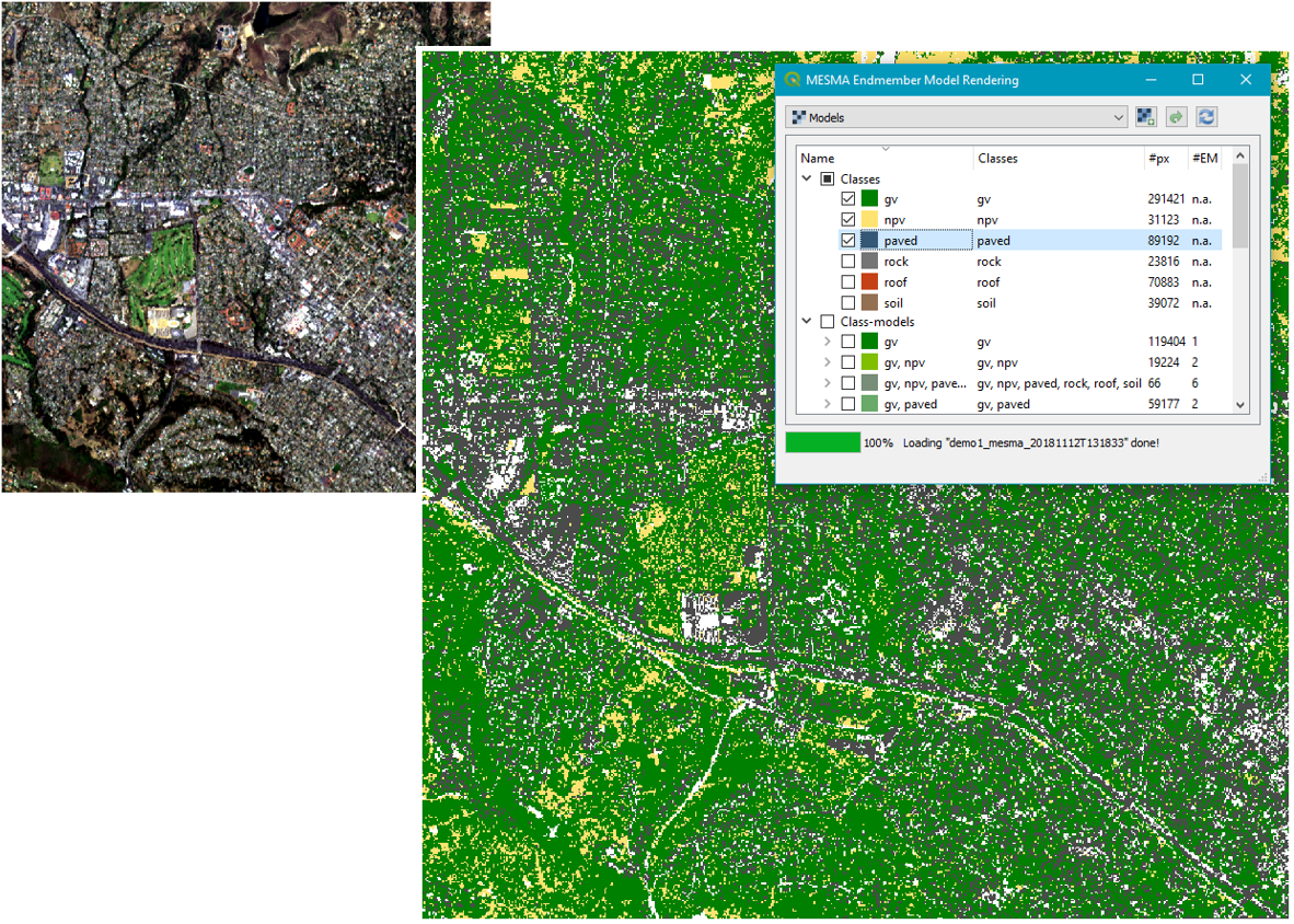
MESMA in QGISMultiple Endmember Spectral Mixture Analysis (MESMA), visualisation of results and other MESMA-related post-processing.
|
MESMA is both a QGIS plugin and stand-alone python package that implements the MESMA (Multiple Endmember Spectral Mixture Analysis) unmixing algorithm in the field of Remote Sensing. It is based on VIPER Tools: a software package written for ENVI/IDL and released in 2007. Several updates have been released since and now it has been ported to PyQGIS in the period 2017 - 2020. The original VIPER Tools is now split over two python/QGIS tools: Spectral Library Tool and MESMA.
|
|
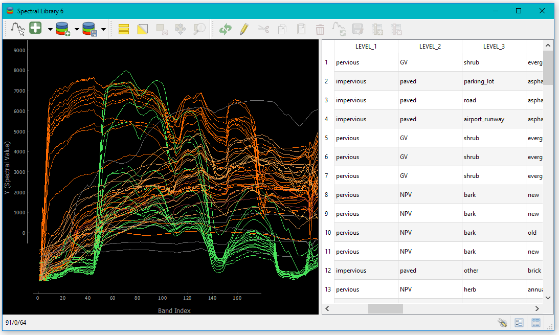
Spectral Library ToolBuild, visualize and optimize spectral libraries.
|
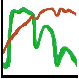
The Spectral Library Tool software package is both a QGIS plugin and stand-alone python package that provides a suite of processing tools for multi- and hyperspectral spectral libraries. The software is based on VIPER Tools: code written for ENVI/IDL and released in 2007. Several updates have been released since and now it has been ported to PyQGIS in the period 2017 - 2020. The original VIPER Tools is now split over two python/QGIS tools: Spectral Library Tools and MESMA.
|
|
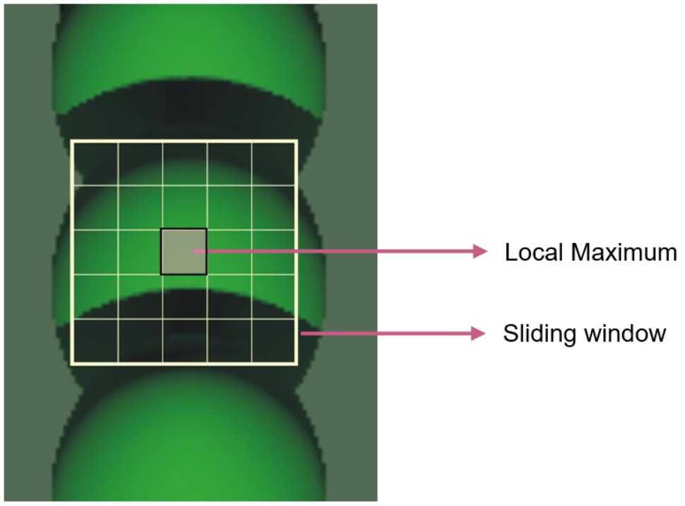
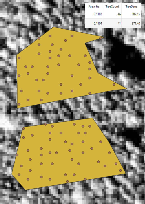
Tree Density CalculatorCalculate the tree density of a given region, by moving a sliding window over a brightness image and detecting local maxima. |
The Tree Density Calculator is a QGIS plugin and command line interface package designed to calculate tree densities based on brightness images, using the local maximum of a sliding window. The original Tree Density Calculator was written in C++ and ported to PyQGIS in 2018/2019. It has been developed in an open source environment to encourage further development of the tool.
|
|
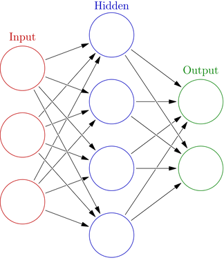
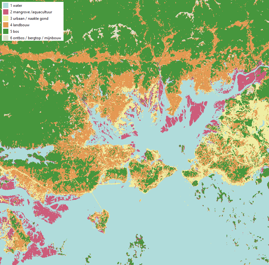
Neural Network MLP ClassifierSupervised classification method for multi-band passive optical remote sensing data, based on the MLP (multi-layer perception) neural network classifier by scikit-learn. |
The Neural Network MLPClassifier software package is both a QGIS plugin and stand-alone python package that provides a supervised classification method for multi-band passive optical remote sensing data. It uses an MLP (Multi-Layer Perception) Neural Network Classifier and is based on the Neural Network MLPClassifier by scikit-learn. The program was originally developed by Lieven P.C. Verbeke (Ghent University, Laboratory of Forest Management and Spatial Information Techniques). It was written in C++ and ported to PyQGIS in 2019 - 2020. It has been developed in an open source environment to encourage further development of the tool.
|
|
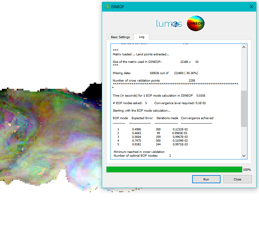
EOF-based Time Series ReconstructorImage reconstructing algorithm based on EOFs (empirical orthogonal functions), designed specifically for oceanography. |
The EOF-based Time Series Reconstructor software package is a QGIS plugin that provides a EOF-based reconstruction tool for filling gaps, caused by e.g. clouds, in geophysical time series, like ocean temperature. It is developed specifically for oceanography. The software is based on DINEOF: a FORTRAN tool in continuous development since 2008. The software has now been developed in the open source environment to encourage further development of the tool.
|
|
FORCE4QVisualize FORCE Level-2 outputs or Landsat/Sentinel2 Level-2A products in QGIS. |
FORCE4Q is a QGIS plugin for generating higher level EO data products, It is a QGIS port for the higher level functionality of the Framework for Operational Radiometric Correction for Environmental Monitoring (FORCE). It specifically makes use of FORCE’s Higher Level Processing System for generating image composites and time series from multitemporal Level 2 bottom of atmosphere surface reflectance imagery. FORCE4Q is compatible with Landsat 5-8 and Sentinel-2 reflectance imagery as downloaded from common online repositories.
|
|
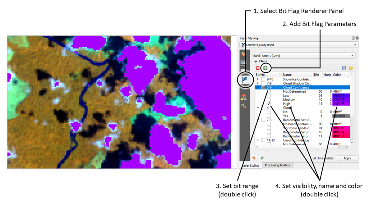
Bit Flag RendererVisualisation of individual bit flags in the Quality Assurance (QA) band of common EO data like Landsat, MODIS or FORCE L2). |
The Bit Flag Renderer is a QGIS Plugin to visualize bit flags in raster quality images. The Bit Flag Renderer is developed at Humboldt-Universität zu Berlin, Earth Observation Lab.
|
|
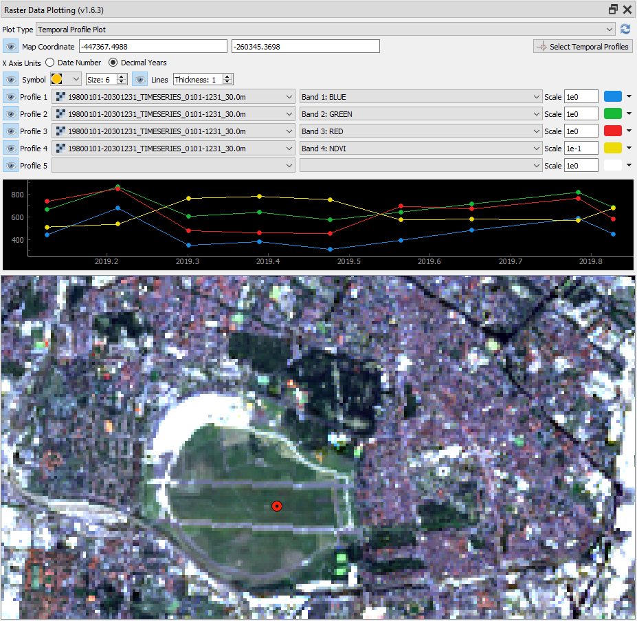
EO Time Series ViewerInteractive visualization and labelling of time series data that is composed of different spatial, spectral and temporal domains. |
Get help in transforming your code to a QGIS plugin, but also:
|
OTHER STEREO AVAILABLE DATA & TOOLS
Onderzoeksteams betrokken bij het STEREO-programma hebben ook datasets & software ter beschikking gesteld buiten het LUMOS-project. Hieronder een selectie.
ACOLITE#atmosphere
|
ACOLITE combines the atmospheric correction algorithms for aquatic applications of Landsat and Sentinel-2 developed at RBINS. This repository hosts the (more) generic version of ACOLITE with the aim of bringing together the processing of all different sensors. ACOLITE allows simple and fast processing of imagery from various satellites, including Landsat (5/7/8) and Sentinel-2/MSI (A/B), PlanetScope and RapidEye, Venµs, SPOT and Pléiades, WorldView-2 and -3, and Sentinel-3/OLCI (A/B) for coastal and inland water applications. |
|
ALBERI Dataset & Software#atmosphere |
The overall objective of the ALBERI project was to narrow down the uncertainties in isoprene emission estimates, especially regarding the response of biogenic isoprene emissions to droughts. The project led, among other results, to |
|
Complete InSAR suite developed by the signal Lab of CSL#SAR |
The Centre Spatial de Liege (CSL) has a long standing experience in the frame of SAR processing and SAR interferometry (InSAR). In the frame of numerous projects mainly funded by BELSPO and ESA, the signal Lab of CSL has developed a complete InSAR suite now known has CIS. CIS, as all tools of its kind, allows performing all processing steps for InSAR, DInSAR, PolSAR, PolInSAR, … including geoprojection of results in raw or ENVI format. |
|
Dasymetric mapping in GRASS GIS#biodiversity
|
“r.area.createweight” is aGRASS-GIS add-on that has been developed in the frame of the DASYWHEIGHT project. This simple and convenient ready-to-use tool facilitates the implementation of a machine-learning based approach to produce weighted layers for dasymetric mapping. Dasymetric mapping redistributes a response variable (e.g. population count) available at a coarse spatial unit level (e.g. administrative units), into a raster grid with a finer spatial resolution. The tool can be used for a wide variety of spatial phenomena, from the mapping of human or animal populations, to the mapping of other socio-economic or environmental variables. In addition, the tool is accessible to non-programmer users, in order to encourage a more widespread uptake of these approaches. |
|
DIARS toolbox#hyperspectral
|
This website is part of the DIARS project that brings together European experts from remote sensing and ecology to demonstrate and characterize the impact of invasive species on ecosystems through the combined use of field data and data obtained through remote-sensing technologies and support the monitoring and prediction of spread and risk assessment of invasive plant species. It consists of a series of tutorials that walk you through a remote sensing-based framework for mapping, modelling and assessing the impact of biological invasions. |
|
EarthTrack Mangroves
|
The monitoring system created in the MAMAFOREST project is accessible via the mobile application Earthtrack mangroves. This monitoring system includes:
|
|
ICOR#atmosphere
|
iCOR is part of the Atmospheric Correction Inter-comparison eXercise (ACIX) organized by ESA and NASA. iCOR is an atmospheric correction software which can be used to process a variety of airborne and satellite images. It can be used to process data for coastal waters, inland waters and land surfaces. Since November 2018 iCOR can also be used to process drone images collected above water. iCOR is available for MERIS, Proba-V, Deimos, Sentinel-2, Sentinel-3 and Landsat-8. iCOR can be downloaded after registration. The iCOR software is developed through funding from the Belgian Science Policy, The European Space Agency and the European Commission. |
|
INPLANT#landcover
|
The general objective of the INPLANT project was to develop a novel ‘optical types’-based approach to evaluate and to predict the impact of invasive plant species on ecosystem functioning. The functional trait and spectral data acquired are stored in the Ecosis library: Individual forb and grass species spectra measured on field patches and on a black table. The functional plant traits measured are stored in the TRY database: Forbs and grasses in North East Belgium, datasetID: 617 |
|
MAUPP Software#population
|
The MAUPP project addressed two specific objectives:
During the project, all the methods were developed with a particular focus on automation and transferability. The mapping frameworks and other computer code developed as well as the final maps are made available through different public repositories, at no cost, for anybody and for any purpose. |
|
Micasense Rededge correction |
In the frame of the STEREO DISSUP MS-SOC project, linked to the UAVSOIL project,a workflow with R-based scripts for the Anisotropy Factor (ANIF) correction of Micasense Rededge multispectral images was developed. The workflow consists of:
The general guide, the scripts and the model parameters were made publicly accessible in a repository available at Github.com. More info |
|
MIMO#SAR
|
The main objective of MIMO was to quantify basal melt of ice shelves surrounding the Antarctic ice sheet at high spatial and temporal resolution to derive improved parametrizations for use in ice sheet modelling studies. |
|
MULTI-SYNC#water |
Within MULTI-SYNC advanced ocean colour products were developed (i.e. remote sensing reflectance, turbidity, and chlorophyll a concentration) through synergetic use of multi-scale EO data. As a new production unit within CMEMS, the high-resolution coastal service (HR-OC) offers ocean colour products based on Sentinel-2/MSI data:
The products are available to the community through the CMEMS distribution platform. |
|
REACT Products, Software & Codes#population
|
The REACT (Remote Sensing for Epidemiology in African CiTies) project involved the use of a wide suite of remotely sensed variables at different spatial and temporal resolutions, and different modelling approaches, with two main goals:
Several products developed during the project have been deposited in open access scientific repositorie such as Zenodo. |
|
RESIST Codes#hazard |
The RESIST project has contributed to the understanding of the source mechanisms driving volcanic eruptions and landslides in the area extending from North Tanganyika to North Virunga by:
The codes for the satellite-based threshold calibration for landslides is shared as supplementary material in the papers Monsieurs et al. 2019a, 2019b. Also available through https://github.com/emonsieurs/ARSthreshold. See also Complete InSAR suite developed by the signal Lab of CSL. |
|
SAT-EX Codes & Data#climate
|
The SAT-EX project focused on the impact of climate and climate extremes on global vegetation. Different source codes are freely available via the Laboratory of Hydrology and Water Management (LHWM) github channel:
|
|
TACT#atmosphere |
TACT is the Thermal Atmospheric Correction Tool for Landsat developed at RBINS. It retrieves ERA5 atmospheric profiles and uses libRadtran to compute the atmospheric transmittance, and down- and upwelling radiances. Currently TACT outputs the Water Surface Temperature (WST) in each thermal band present on the Landsat sensor, assuming a constant (water) emissivity over the scene. |
|
TREX#landcover |
TREX (Tool for Raster data EXploration) is an automatic processing tool allowing extraction of Time series of Leaf Area Index (LAI) from Proba-V satellite images. TREX was developped for the STEREO III HIWET (High-resolution modelling and monitoring of water and energy transfers in wetland ecosystems) project and is available on GitHub. |
|
VIPER Tools
#landcover
|
The VIPER Tools software package is an ENVI add-on that provides a suite of processing tools for multiband passive optical remote sensing data including hyperspectral and multispectral imagery. The major components of the software are tools for creating and managing spectral libraries, for selection of optimal endmembers for Spectral Mixture Analysis (SMA) and for calculating and interpreting SMA and Multiple Endmember Spectral Mixture Analysis (MESMA). |
|
3D-FOREST & 3D-TERRAIN#forest |
The 3D-FOREST project aimed at providing novel lidar in-situ 3D forest structure and biomass estimates to validate large-scale air/spaceborne biomass products. The 3D-Terrain project, has extended the use of LiDAR Unmanned Aircraft Systems to characterise termite mounds in tropical savannas. The algorithm 3DTerrain-TermiteMounds is also freely availbale on Github. |

