Context and objectives
![]()
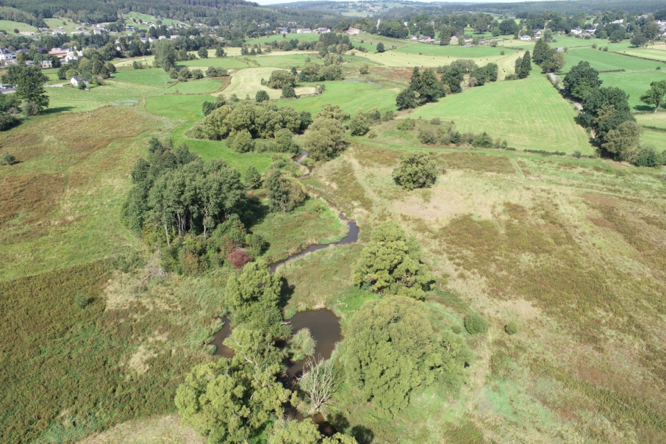
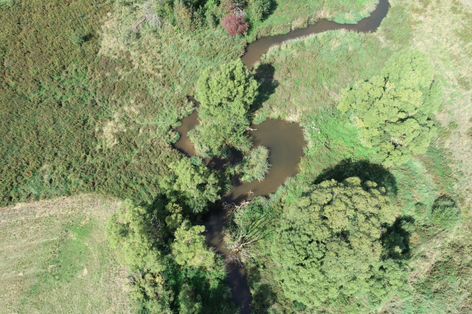
Riparian zones are central landscape features providing several ecosystem services and are exceptionally rich in biodiversity. In our project, remote sensing techniques will be used to develop automated analysis of the regional river network and riparian buffer.
Project outcome
Scientific results
The project outcomes and methods will be promoted through several research articles, both for science popularization and peer‐reviewed publications. More specifically, 2 research articles (peer review) were planned:
Paper n°1: Can regional aerial images from orthophoto surveys produce high quality height model in forest context? A single tree approach in Western Europe. Paper submitted to International Journal of Applied Earth Observation and Geoinformation (Elsevier). Final stage of revision.
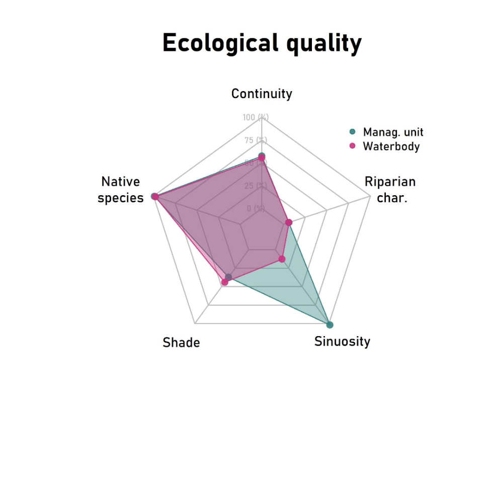
Paper n°2: Characterization of riparian zone quality using hybrid time series of CHM and satellite imagery. This project of paper will be further published, outside the frame of the RiReMo project.
Societal (including environmental) relevance
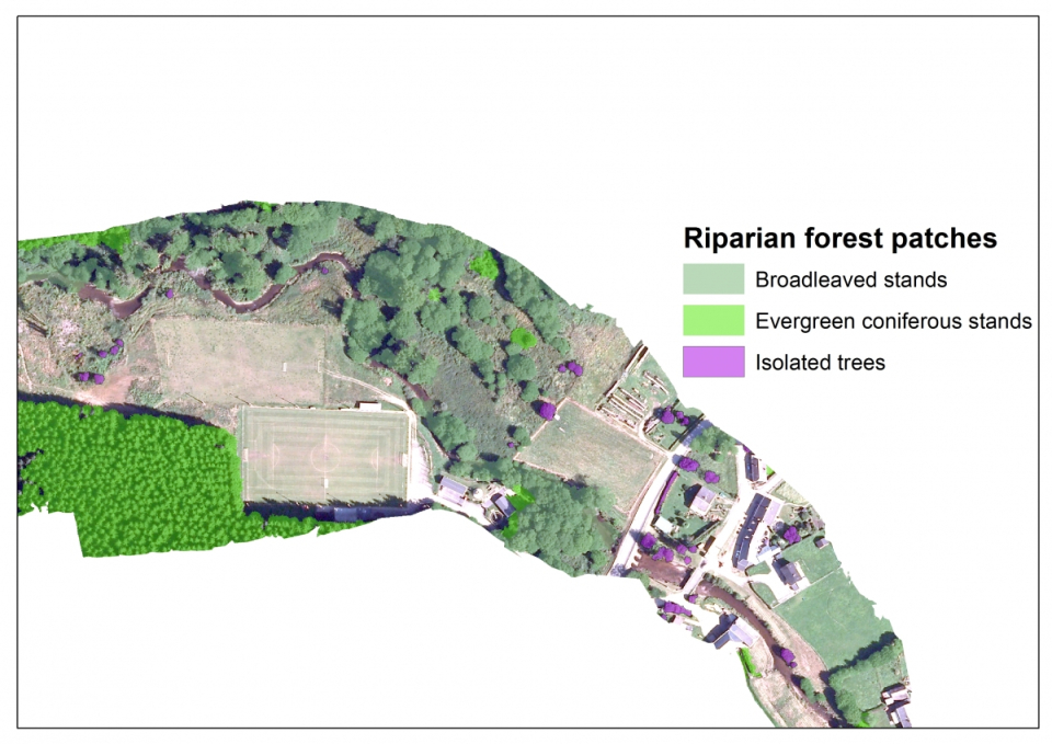
The RiReMo project has produced indicators characterizing the riparian area in Wallonia at very fine spatio-temporal scales. In the frame of this project, the Walloon administration has been trained to reproduce the outcomes of the project and integrate remote sensing approach onto their monitoring program. The results of the project will be soon integrated by the administration onto an online platform which will provide decision making tools (maps, summary sheets) for field river managers.
Thanks to their full integration in the online decision making tools platform, the results of the project will be use to promote the multi-functionality of river management in Wallonia as well as to target future restoration activities.
Products and services
Different dataset produced in the frame of the WP1 will be made available by the administration on the Walloon geoportail (see section 3.1 of this document). The FTP server kept active until the end of 2020 gathers all project outcomes (summary sheets, maps, datasets, training sessions, …). The results of the project will be soon integrated by the administration onto an online platform which will provide decision making tools (maps, summary sheets) for field river managers.
Potential users
The main users of the project results are indeed the river managers of Wallonia even if other environmental mangers could benefit from this work. As the online platform will be open to external users, the results of the project can be reached by a general audience, from other administrations to the general public.
Outreach
RiReMo: Riparian zones viewed from the top
| Project leader(s): | ULg (Université de Liège) | |
| Location: |
Country:
Region:
|
|
| Related presentations: | ||
| Website: | http://www.gembloux.ulg.ac.be/gf/riremo/ | |