Published on 15 February 2022
Monika Kuffer is Assistant Professor at the Faculty of Geographic Information Sciences and Earth Observation at the University of Twente. She is also an international partner of the STEREO project SLUMAP (Remote Sensing for Slum Mapping and Characterization in sub-Saharan African Cities), whose objective is to develop an open-source framework allowing the processing of remote sensing images to map and characterize the physical environment within the slums.
An article about her work has just been published on the University of Twente website.
 The overall objective of the STEREO project SLUMAP is to contribute to Sustainable Development Goal 11 "Make cities and human settlements inclusive, safe, resilient and sustainable" by (i) improving our understanding of the potential of remote sensing for sensing and characterization of slums and (ii) developing a general, scalable and open-source methodological framework for sub-Saharan Africa, to support this task and meet the requirements of stakeholders in the era of big data.
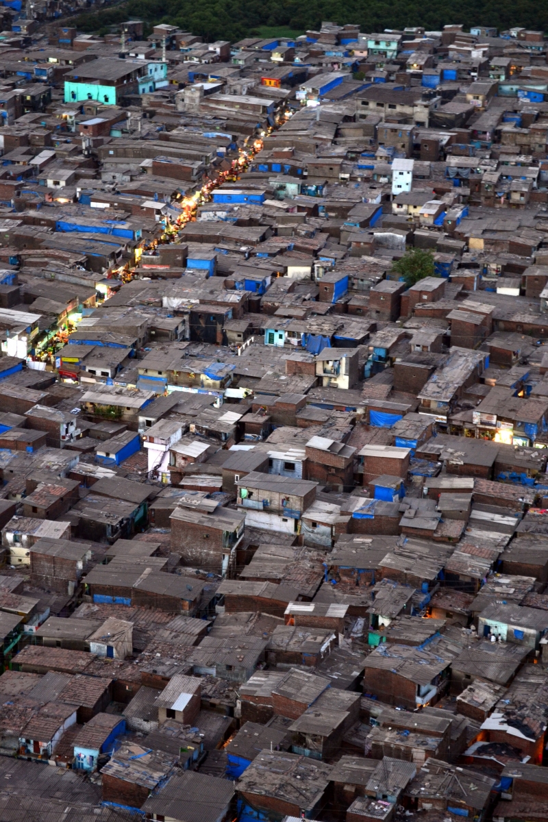
A City of 38 Million People
“According to the United Nations, 90% of the population growth in the coming 30 years will happen in the Global South”, Kuffer says. “For example, the urban agglomeration of New Delhi in India might reach a population size of 39 million inhabitants in 2030, which is more than the present continent of Oceania and will be barely manageable. Large parts of these cities, the so-called deprived parts, have inadequate housing, almost no access to services and an insufficient infrastructure. It leads to poor living conditions and low life expectancy.” Kuffer prefers to speak of the term ‘deprived areas’ instead of slums. These areas meet more problems than water, sanitation, overcrowding, the housing condition and the land tenure. They also suffer from built-up densities and various hazards.
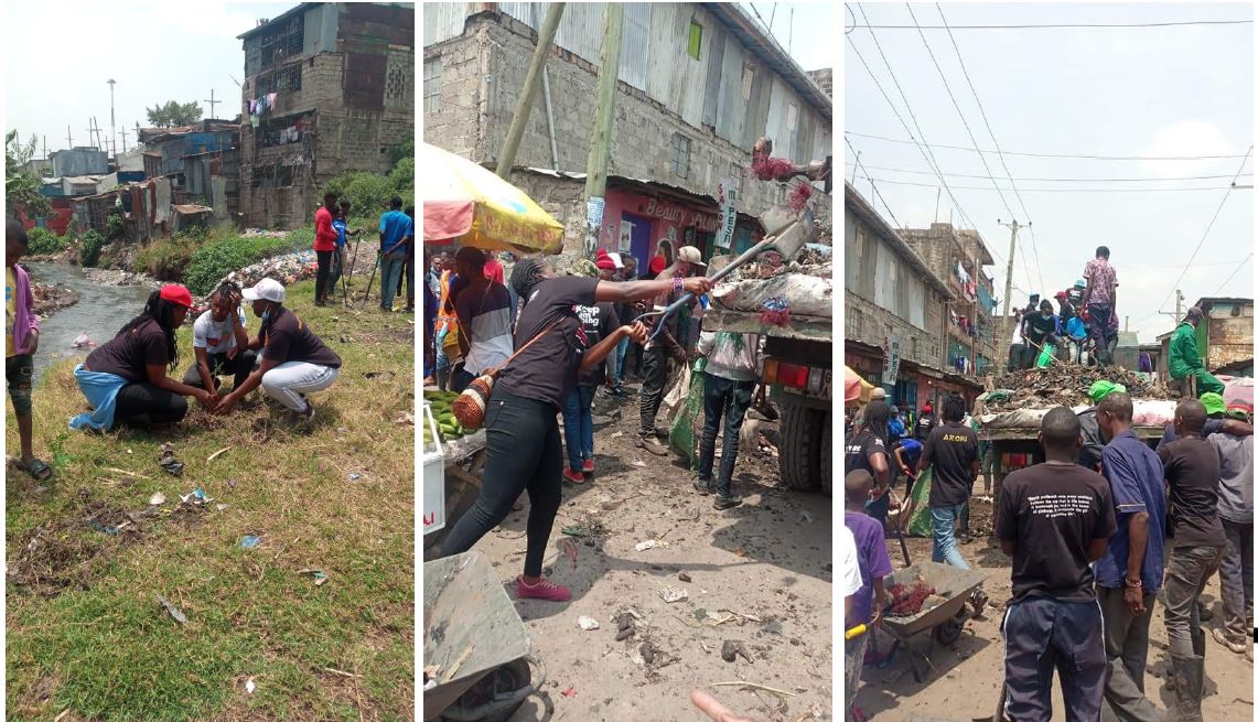
Waste Concentration
Monika Kuffer has worked a lot in African cities and knows the situation on the terrain well. “60% percent of inhabitants of Nairobi in Kenia live in informal settlements, which covers about 5% of the built-up area. These are overcrowded areas with a lot of environmental and social problems. We mapped the waste concentration in a couple of settlements in Nairobi. The data helped to convince the local authority to clean up the waste. The problem is governments base their policy on rough estimates and old statistics. There is dramatic lack of accurate data because it’s hard to have access to the dense slums and cities are changing so rapidly."
Slumdog Millionaire
Reliable data are needed for urban planning and decision-making. Kuffer and her fellow-researchers of ITC want to bridge this data gap by using satellite images (remote sensing). The aim of the research, which is awarded a Veni grant, is to build spatial models, based on Earth observation.
|
“There is a lot of undercounting in mapping the population. In many cases slums are not covered at all in population data, because they might be temporary settlements”, Kuffer states. A famous example is the Dharavi slum in Mumbai, where the movie Slumdog Millionaire took place. Global population models estimate that around 50,000 people are living in this area. “But if you look at the localized population models, you come to almost 1 million people. There is no accurate counting, due to all kinds of problems such as security. In Bangalore we found 1,500 slums on the ground, but the official statistics assume 600 slums!” |
Wrong Data
Decision makers in developing countries base their policy and urban planning on wrong data sets, which means that they miss many people in deprived areas. Kuffer and her ITC-colleagues work together with local community groups to find out how many people really live in the area. “These groups and their issues are systematically ignored in global data sets. They are not heard with their issues. I want to build better models and data sets that combine global data with community-based data. I want to highlight local issues and strengthen their voices. Especially in Africa, where the data gaps are enormous and the number of smaller (secondary) cities is growing very fast.”
EducationMonika Kuffer teaches earth observation courses to students of ITC. She also developed a program about competitive cities for the course Urban Planning and Management. “People often think of the economics aspects of cities, but I focus on competitiveness in the sense of inclusiveness. Cities with a lack of education, infrastructure, and services for the urban poor, will lose in the end.” Education is important to Kuffer. “Research cannot exist without education, and vice versa. I use the outcome of research for courses, but also the insights of students for my research. It’s an important ecosystem, a circle of life.” |
|

More information
Read the original article:
Mapping the deprived areas - Dr Monika Kuffer