Published on 5 February 2021
A team of researchers, including many STEREO researchers, has just published in the journal Remote Sensing the results of a study that paves the way for a new application of multispectral remote sensing: assistance in the certification of organic crops.
The annual certification of organic agriculture products includes an in situ inspection of the fields declared organic. This inspection is more difficult, time-consuming, and costly for large farms or in production regions located in remote areas.
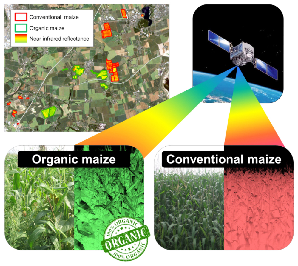
The research team attempted to assess how spatial remote sensing may support the organic crop certification process by developing a method that would enable certification bodies to target for priority in situ control crop fields declared as organic but that would show on satellite imagery an appearance closer to conventional fields.
For this purpose, the ability of multispectral satellite images to discriminate between organic and conventional maize fields was assessed through the use of a set of four satellite images of different spatial and spectral resolutions acquired at different crop growth stages over a large number of maize fields that are part of an operational farm in Germany.
 |
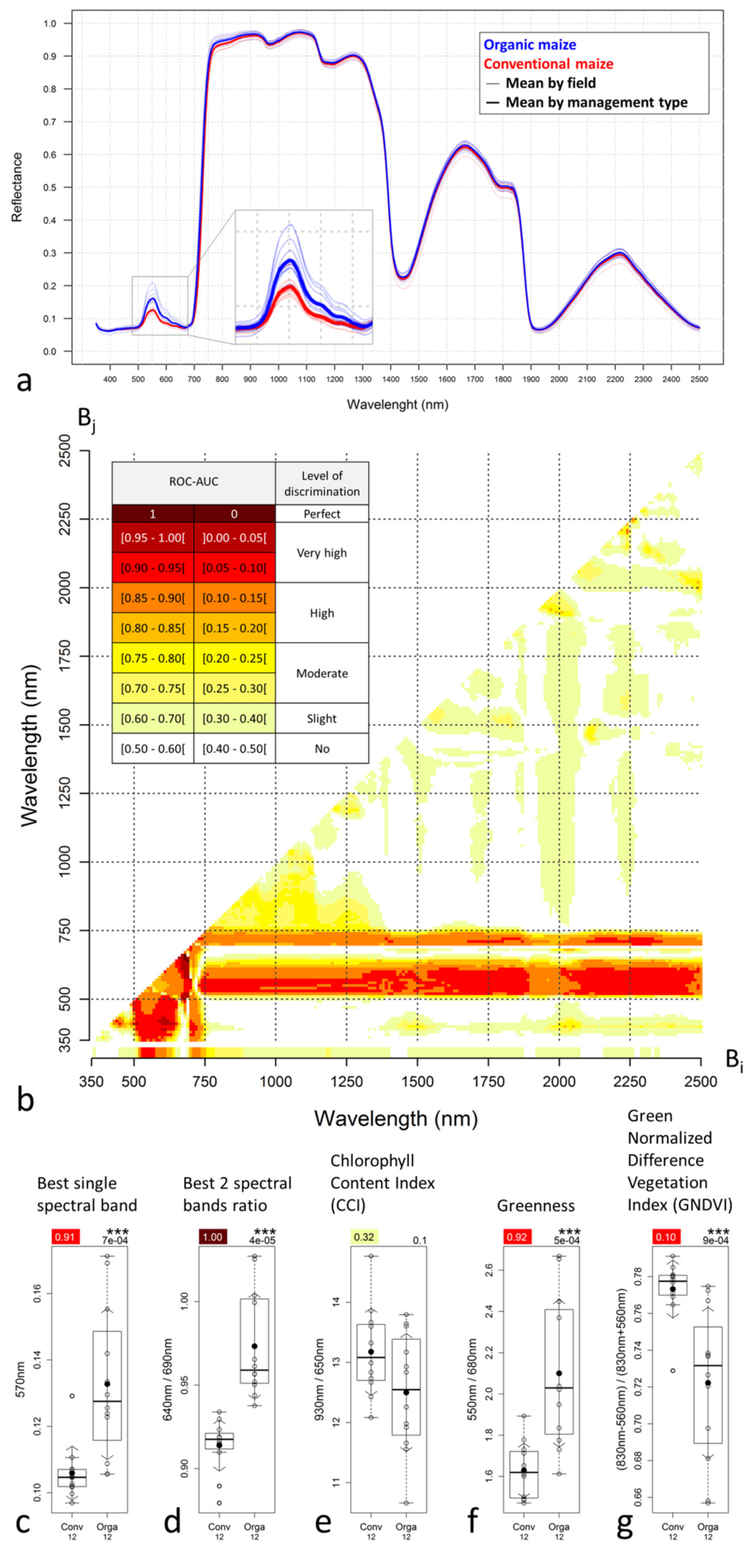 |
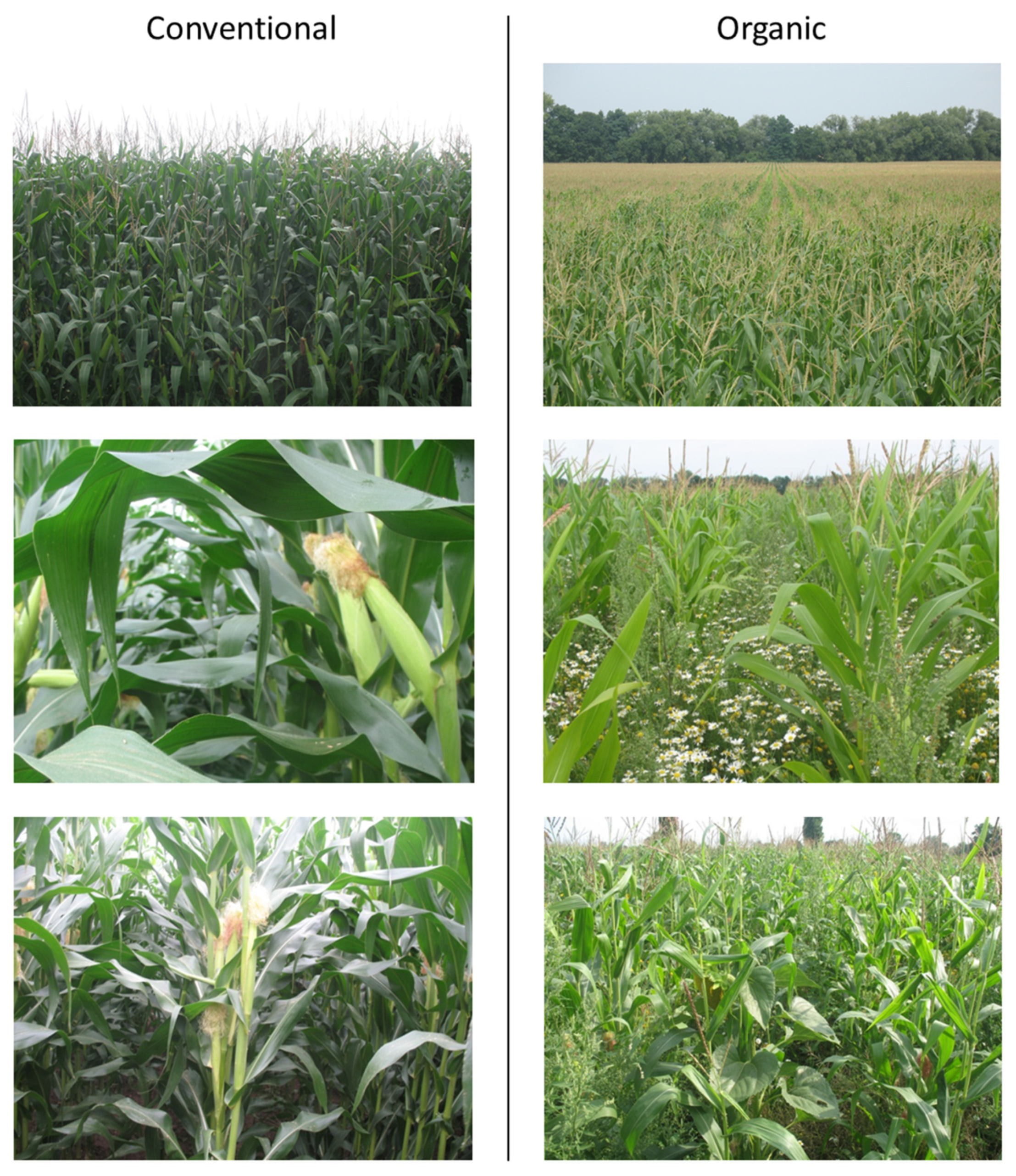
In support of this main objective, a set of in situ measurements (leaf hyperspectral reflectance, chlorophyll, and nitrogen content and dry matter percentage, crop canopy cover, height, wet biomass and dry matter percentage, soil chemical composition) was conducted to characterize the nature of the biochemical and biophysical differences between organic and conventional maize fields.
The results of this research showed that highly significant biochemical and biophysical differences between a large number of organic and conventional maize fields may exist at identified crop growth stages and that these differences may be sufficiently pronounced to enable the complete discrimination between crop management modes using satellite images issued from quite common multispectral satellite sensors through the use of spectral or spatial heterogeneity indices. These results are very encouraging and suggest, for the first time, that satellite images could effectively support the organic maize certification process.