Published on 21 January 2022
The Walloon Region has more than 2,200 abandoned sites suitable for rehabilitation. These are mainly former industrial areas or brownfield whose current state represents a deconstruction of the urban canvas but which also provide a real opportunity for sustainable urban planning.
Help from above
The complete update of the inventory of these sites, which are spread throughout the region, is essential in order to provide up-to-date information to the various actors. Traditionally, this is done through field visits by agents and is therefore both very costly and extremely time-consuming. However, each year, less than 10% of these sites are rehabilitated, in whole or in part.
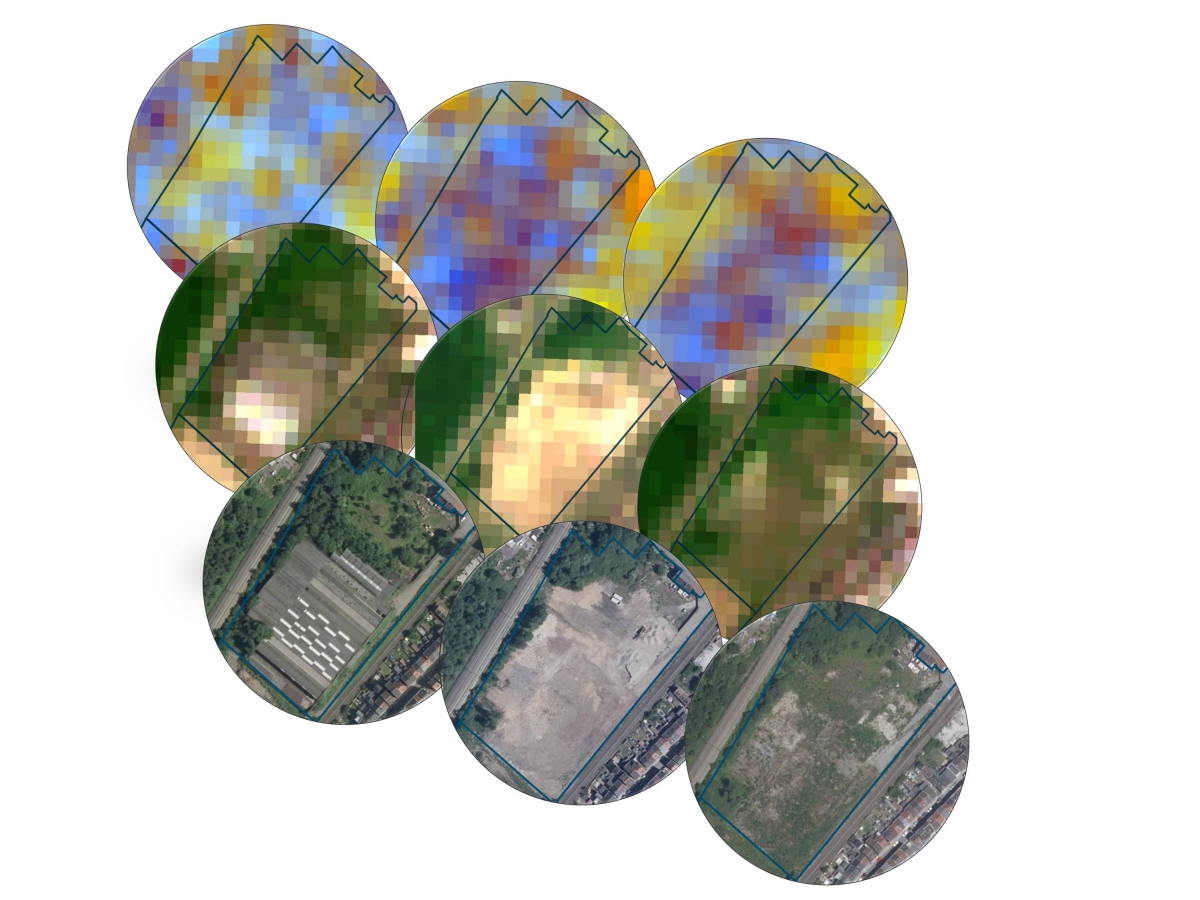
Example of a change on a redevelopment site (RDS) with, from top to bottom, Sentinel-1, Sentinel-2 images and orthophotos
In order to help manage this inventory, the STEREO III programme financed the SARSAR project (Automatic redevelopment sites monitoring using SAR and OPTICAL images), carried out jointly by the Service Public de Wallonie, the ISSeP (Institut Scientifique de Service Public) and the Royal Military Academy (RMA). The objective was to develop an operational tool for automatic site monitoring using Sentinel-1 and -2 images from the European Copernicus programme. This tool should make it possible to
- detect changes
- determine the type of change;
- indicate the direction of the change and its amplitude;
- provide a confidence index per change.
Analysis of the changes observed allows new sites to be identified, others to be eliminated and makes it possible to determine which sites require a field visit as a priority.
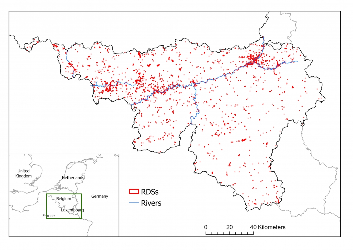
Study area (green rectangle), with the spatial distribution of the RDSs in Wallonia (red dots).
Combining radar and optics in Terrascope
The tool developed exploits the complementarity between data from the Sentinel-1 satellite, which acquires C-band SAR images, and those from Sentinel-2, which is equipped with a multispectral imaging system.
On the one hand, Sentinel-1 is sensitive to variations in shape, height and water content. On the other hand, Sentinel-2 optical data allow the identification and classification of changes in land cover. Moreover, their frequent revisit time (2 to 3 days over Wallonia) and their free access make them relevant tools for the automatic change detection at the regional scale.

Example of a changepoint analysis showing the orthophoto ground truth (left: summer 2017, center: summer 2018, right: summer 2019)
and bi-dimensional time series sigma0VH and NDVI.
The general methodology includes the following stages:
- A framework based on a first filter to remove unusable data (e.g. cloudy optical images) and extraction of temporal features
- Time series feeding a processing block in charge of change detection;
- Implementation of a rule-based classifier to quantify and classify changes into different types of land cover (vegetation, building and soil), also providing information on the direction of the change (increase, decrease), the amplitude and a confidence index.
The process is implemented in the TERRASCOPE platform, the Belgian contribution to the Sentinel Collaborative Ground Segment, as it provides pre-processed Sentinel data and computer capacity for the automatization.

Close-ups of two RDSs showing (a) vegetation decrease and soil change; (b) building increase and soil change
Limiting the artificialization of soils
As 85% of the disused sites are located in urban areas, their rehabilitation avoids urban sprawl and therefore limits land artificialisation. The European Union has decided to implement policies to achieve "No net land take by 2050" and thus avoid the replacement of agricultural, forest and natural land with sealed and artificial soils that can no longer ensure natural processes such as chemical decomposition or rainfall absorption, the benefits of which are of primary importance. The STEREO III project SARSAR promotes the more rapid rehabilitation of abandoned sites by facilitating access to information on changes in these zones, thus helping to meet one of the crucial challenges facing Europe today.
More information
Automatic redevelopment sites monitoring using Sentinel data (Terrascope)
Change detection analysis on walloon brownfield sites (NEREUS)