Published on 3 May 2021
The return of spring temperatures in the northern hemisphere is melting the snow accumulated during the winter months, releasing in the streams, rivers and oceans of the planet the fresh water essential to more than a billion people in the world. Estimating the quantity of water stored in the snowpack of our planet is therefore essential but also particularly difficult (see this article).
With the objective of designing a future satellite mission to measure the amount of snow on Earth, NASA organized two intensive field campaigns during the winters of 2018 and 2020. These campaigns are part of the SnowEx Programme and were carried out at Grand Mesa, a vast plateau at high elevation (~3500 m) in central Colorado in the United States. An international team of researchers specializing in snow science and remote sensing have collected a set of aerial and terrain data in order to be able to study and compare new concepts of remote sensing of the snow mass.
 Traversing the high-elevation plateau of Grand Mesa in Colorado with snowmobiles during the NASA SnowEx 2020 campaign. During the traverse, snow depth measurements are collected from a radar sensor mounted on top of the snowmobile.
In the framework of the STEREO project SNOPOST, researchers from KU Leuven participated to both campaigns and helped collect in situ observations of snow depth and detailed snow properties in pits.
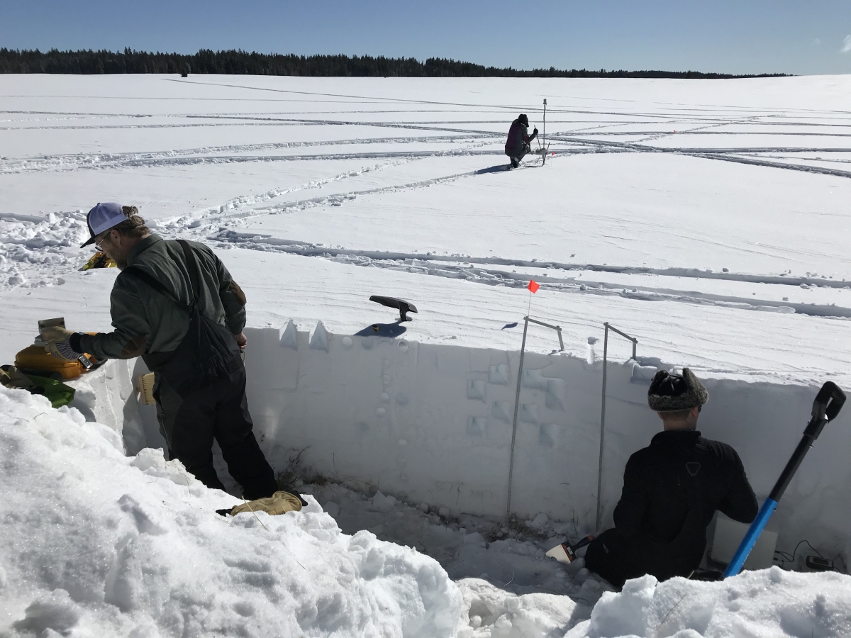 Detailed snowpack properties are measured in a snow pit during SnowEx2020: snow depth, stratigraphy or layering of the snowpack, snow grain size and shape, temperature, liquid water content, density, and specific surface area. In the distance, transect measurements of snow depth and snow layer properties are collected with a micro-penetrometer.
The work carried out within the SNOPOST project has enabled Belgian researchers to develop a new method for measuring snow depth, which has been published in the journal Nature Communications.
These new satellite estimates have made it possible to create the first spatial data set of snow depth in mountain ranges.
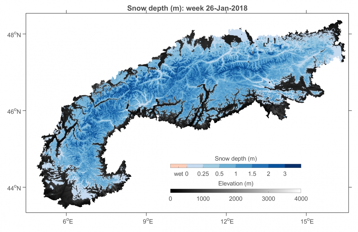
Example of snow depth estimation at a spatial resolution of 300 m in the European Alps.
However, the remote sensing observations have limitations. For instance, they are less accurate in shallow snow with a relatively weak snow signal, in wet snow that causes signal absorption, and in forested regions where the signal is obscured by trees. To overcome these limitations, SNOPOST merged the satellite observations with estimates from model simulations through a technique called data assimilation. The model and satellite estimates are combined in an optimal way, by assigning a higher weight to one or another depending on their uncertainties. For instance, larger weight can be assigned to the model simulations in shallow or wet snow, or in dense vegetation.
SNOPOST demonstrated that the combination of the newly developed Sentinel-1 satellite observations with model simulations improves our knowledge of the mountain snowpack, which can furthermore benefit a range of applications, such as water management, hazard (flood and avalanche) prediction and weather prediction.
More information
STEREO researchers publish a method for measuring snow depth by satellite in Nature Communications
STEREO researcher goes on snow expedition along with NASA
Members of the SNOPOST project team
|
|
|