The Wijnendale Forest, near Torhout, is one of the most important forest areas of West Flanders. The image here shows a part of the forest in the protected nature reserve. It was recorded by the APEX sensor on board an aircraft. This is a so-called hyperspectral sensor, because it is capable of capturing hundreds of spectral bands (wavelength intervals). These sensors provide more detailed information than conventional sensors (3 to 8 spectral bands).
The image was created using the values in three specific wavelengths, i.e. near infrared, red and green. Vegetation appears in red and the various shades of red represent different stages of development or different species.
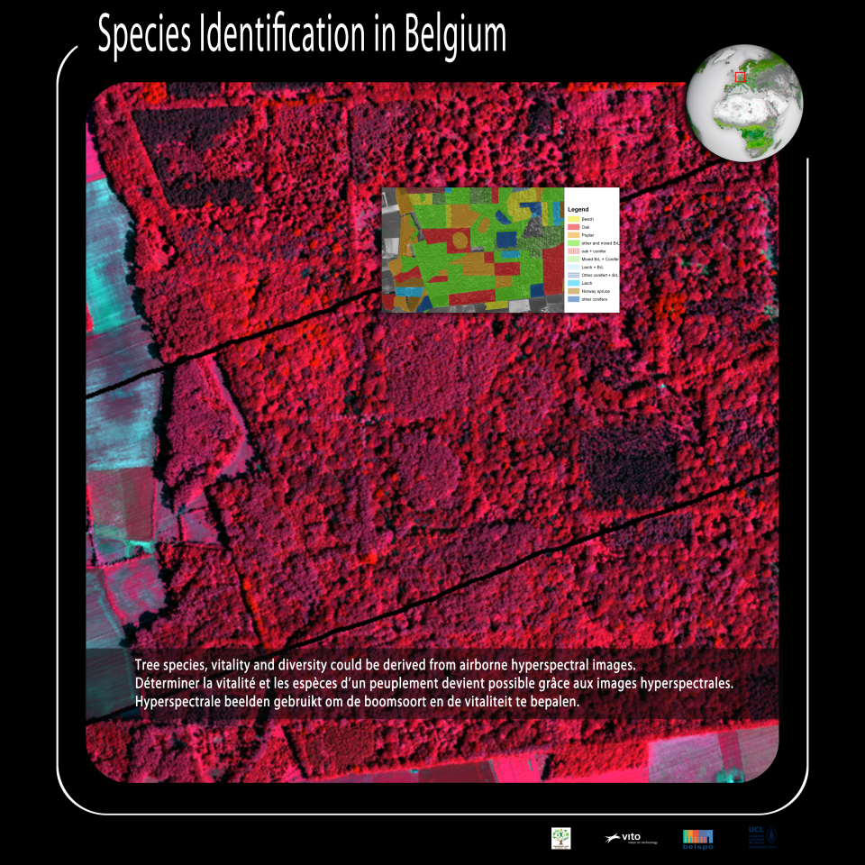
Tree species, vitality and diversity could be derived from airborne hyperspectral images.
“Sustainable” forest management requires information on the diversity and vitality and the composition of the tree population that is both reliable and regularly available.
Until now field measurements were the only way to acquire such information. Field campaigns, however, are often very time consuming and labour intensive. Moreover, some features, such as the structure of the canopy (top layer of the forest), are difficult to measure.
New remote sensing techniques should make it possible to get easier and better data in the future.
Hyperspectral monitoring entails capturing the light reflected from the surface in a very large number of contiguous, narrow spectral bands (or wavelength intervals) located in the visible and infra red part of the electromagnetic spectrum. The obtained information is more accurate than with conventional multispectral sensors, and allows a better distinction between the observed objects. Hyperspectral images make it easier to distinguish between different tree species in a forest stand.
LIDAR (Light Detection And Ranging) is an active surveillance technology based on capturing a backscattered laser beam signal. Using highly detailed LIDAR distance measurements makes it possible to determine the three-dimensional structure of vegetation.
By combining hyperspectral data, LIDAR data and the expertise of foresters, scientists hope to achieve a better forest management.
What’s Sustainable Forest Management?
“The stewardship and use of forests and forest lands in a way, and at a rate, that maintains their biodiversity, productivity, regeneration capacity, vitality and their potential to fulfill, now and in the future, relevant ecological, economic and social functions, at local, national, and global levels, and that does not cause damage to other ecosystems.”
(The Food and Agriculture Organization - FAO- )