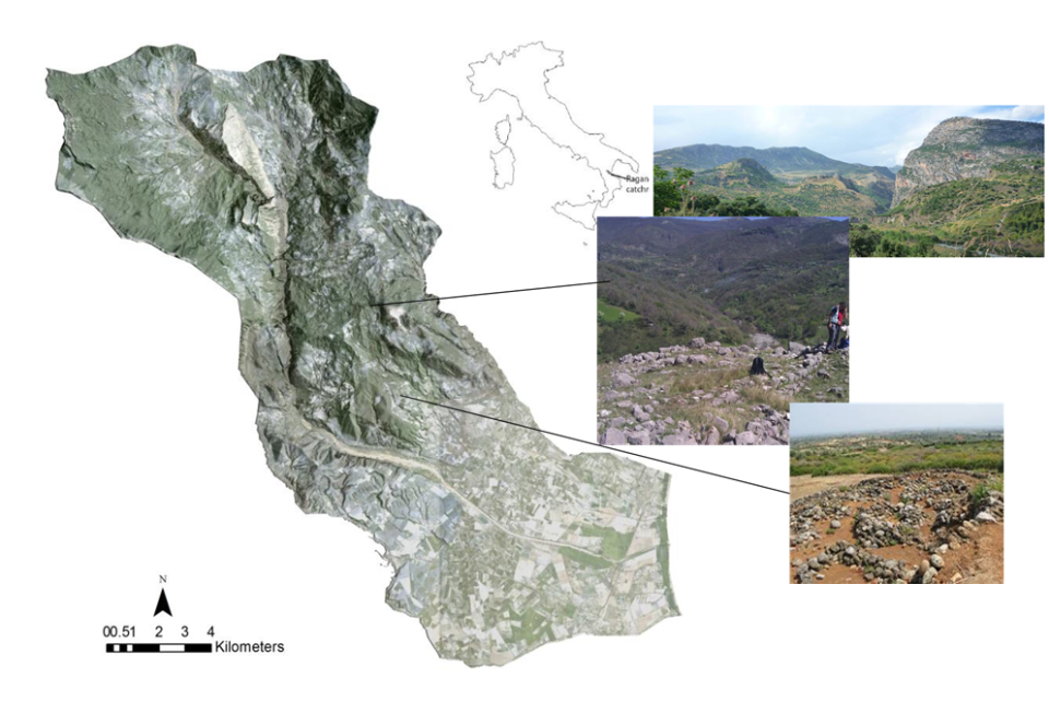
Context and objectives
Advances in RS over the past 30 years, and especially over the last decade have provided new opportunities for geo-archaeological research, especially for identifying areas of high archaeological potential (De Laet et al. 2007, 2008, 2009; Fowler 2001; Garrison et al. 2008; Lasaponara & Masini 2005, 2006a, b; Masini & Lasaponara 2007; Ricchetti 2004; Weller 2006). Because of the relatively small size of archaeological sites and the variability of their shape and spectral properties, the spatial and spectral resolution of any RS data must be extremely high to be really useful. In order to define the resolution requirements one has to develop a methodology and investigate the processes producing remotely sensible geo-archaeological signatures, something that is still missing in present-day archaeological research. To complement research in this domain, focus in this project, which brings together a variety of Belgian and foreign research institutions, is on developing a methodology for investigating signatures of archaeological features as well as for integrated processing of LiDAR and hyperspectral data. The combination of LiDAR and hyperspectral imagery is of major importance since the way in which archaeological spectra appear is strongly dependent on the nature of the landscape context (e.g. Rowlands & Sarris 2007; Cavalli et al. 2009). For example, eroding slopes, colluvial footslopes and terraces where soil is being transferred through cultivation will expose or hide sites through quite distinct processes. LiDAR may provide the (micro-) topographic context for the hyperspectral analysis of archaeological and geomorphic surface features. This project is a spin-off of the RAGALIRS project, which was carried out between November 2007 and March 2009 under the STEREO contract nr. UN/67/015 and UN/01/016. Findings of the RAGALIRS project and the suggestions of the steering committee made clear that the processes producing geo-archaeological signatures are not sufficiently understood. Furthermore, the data collected in the framework of the RAGALIRS project (hyperspectral AHS, LiDAR and field measurements) are not yet fully explored. The central theme of this proposal therefore builds on this experience and these findings. It will take into account the suggestions mentioned above when investigating the depositional and post-depositional processes affecting the RS characteristics of archaeological remains. This will be done on well-defined target sites in order to elaborate on what characteristics a RS system should have in order to detect archaeological remains. Knowledge gained in the first phase of this project will subsequently be used to evaluate the potential of existing hyperspectral and LiDAR data at the same sites, and results will be confronted with those obtained using adapted parameter settings in order to test their added value. Subsequently, results obtained in different physiographic environments will be compared in order to evaluate the applicability of the methodology to different environments. In a final stage it will be evaluated whether the developed methodology enables the reduction of ‘false positive’ phenomena, i.e. the mistaken identification of topographic or spectral anomalies as archaeological sites. In order to achieve these overriding objectives, several WPs addressing particular scientific questions were specified:
- Hyperspectral signatures of archaeological sites and “false positive” phenomena (WP 1)
- Hyperspectral and LiDAR data for integrated processing (WP 2)
- Methodology validation and comparison of different environments (WP 3)
Project outcome
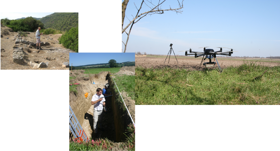
A better understanding of what remotesensing can and cannot achieve at the sites chosen and with the methods used on the basis of an analysis of the soil and its origin.It is important that remote sensing can be carried out precisely when and where required in response to transient local conditions, UAV platforms are likely to be particularly useful:
a LiDAR derived DTM was successfully applied in the archaeological prediction model;
a list of elements influencing the detection potential of archaeological remains:
- the nature of the remains themselves,
- the nature of the natural soil profile,
- the cultivation/land-use state of the ground surface,
- topography,
- the capabilities of the detection system
a set of research pathways to build on this work and explore how a more refined approach may be devised and tested
| Project leader(s): | KULeuven - Department of Earth and Environmental Sciences (EES) | |||
| Belgian partner(s) |
|
|||
| International partner(s) | ||||
| Location: | ||||
| Related presentations: | ||||
| Related publications: | ||||
| Website: | ||||