Among the news items published on this site, you'll find below commented satellite images, webstories explaining the why and how of STEREO projects, press articles and interviews of our researchers, and videos of our partners. Browse through them below by choosing the type of news or by selecting a tag.
STEREO PROJECTS VIDEOS
|
STEREO III Photo album |
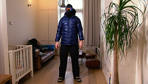
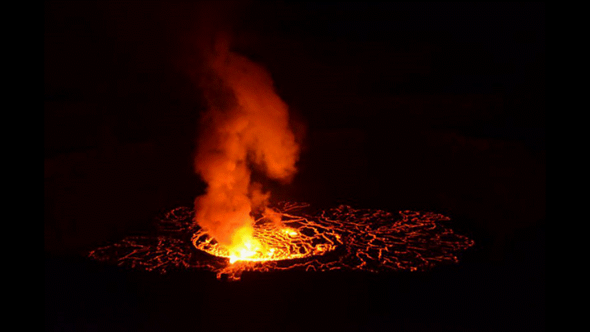
RDC : à la découverte du volcan Nyiragongo, "aux portes de l'enfer - MUZUBI project |
BEETPHEN project, toward drone-based phenotyping in sugar beet breeding trials |
Vlaamse onderzoeker vertrekt samen met NASA op sneeuwexpeditie - SNOPOST & CSNOW projects |
Copernicus4Regions user stories- Interview Wallonia - SARSAR project |
Het hitte-eilandeffect. Hoe voorkomen we snikhete nachten? - URBANEARS project |
|
3D fly-through of Litchfield Savanna TERN supersite - 3D FOREST project |
Field Campaign in Biebrza National Park, Poland - HIWET project |
Drones to monitor water quality - DRONESED project
|
Watch iT Grow, een nieuw online platform voor aardappelmonitoring - iPOT project |
STEREO PROGRAMME
Watch these two videos below to discover in a few minutes what the STEREO programme is and get an overview of some applications covered by the research funded by the STEREO programme.
FEATURED VIDEOS
Source: ESA
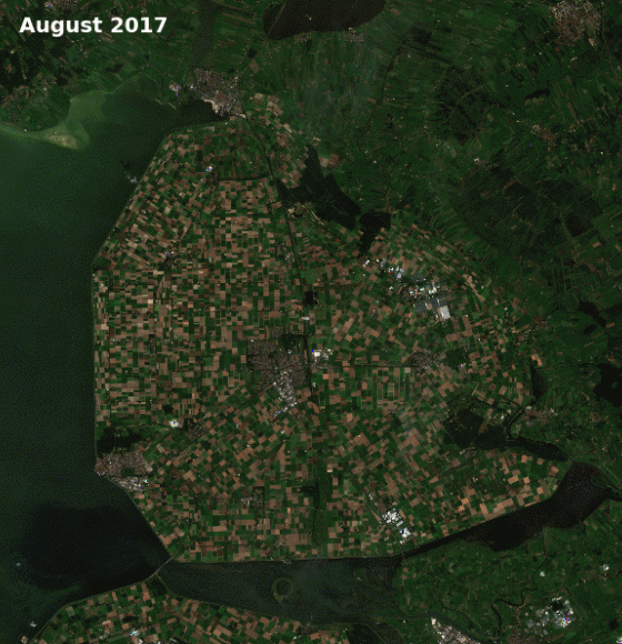
Satellites Safeguard Europe's Potato Industry
Published on 27 September 2018
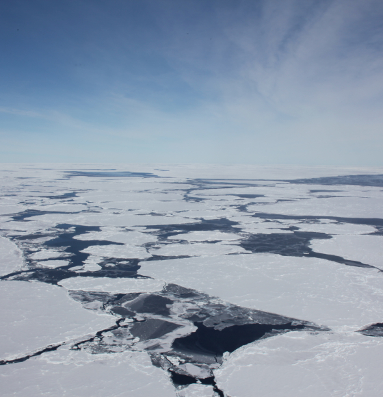
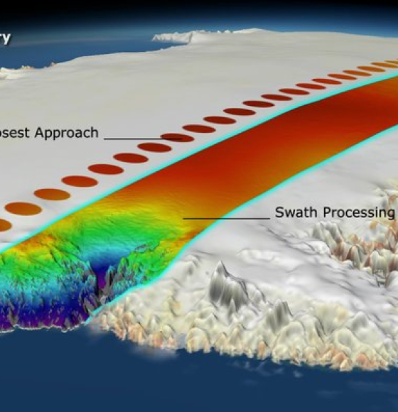
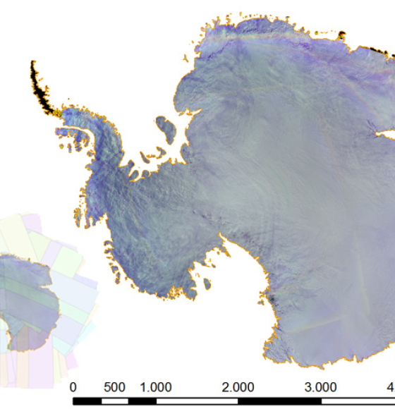
Decades of Satellite Monitoring Reveal Antarctic Ice Loss
Published on 16 July 2018
CryoSat reveals retreat of Patagonian glaciers
Published on 2 May 2018
Moon holds key to improving satellite views of Earth
Published on 2 May 2018
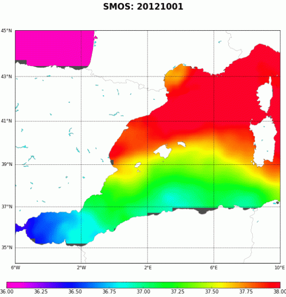
Six years of the new SMOS SSS maps in the Mediterranean Sea now available!
Published on 6 April 2018
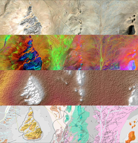
Sentinels helping to map minerals
Published on 23 March 2018
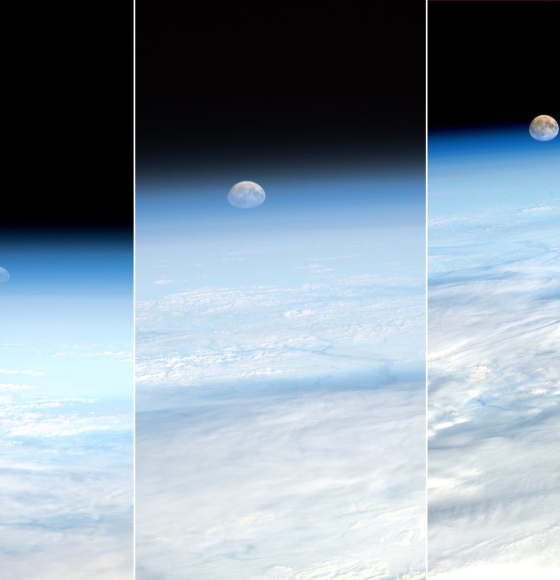
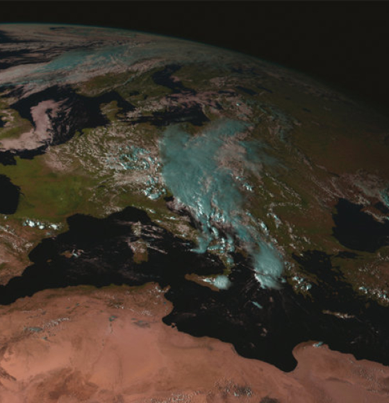
Earth's atmosphere: new results from the International Space Station
Published on 23 March 2018
Farewell to GOES-13: The History of NOAA’s Former GOES East Satellite
Published on 19 January 2018
Accessing Copernicus Data Made Easier
Published on 19 January 2018
Antarctica acquisitions by PROBA-V
Published on 15 December 2017
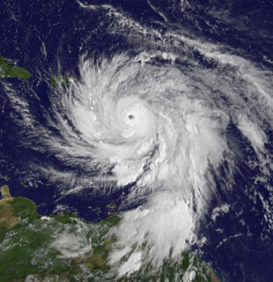
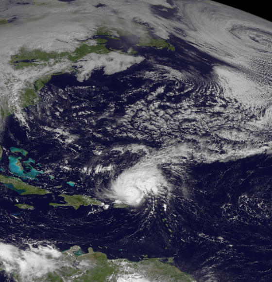
NASA Looks Within Category 5 Hurricane Maria Before and After First Landfall
Published on 20 September 2017
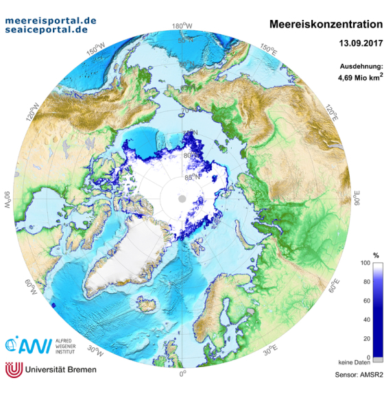
Arctic sea ice once again shows considerable melting
Published on 12 September 2017
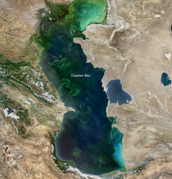
Blooms in the Caspian Sea
Published on 10 August 2017
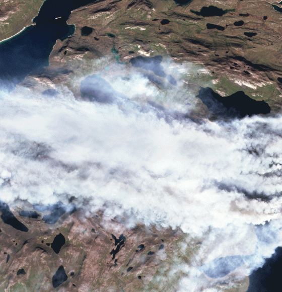
Greenland... Wildfire?
Published on 10 August 2017
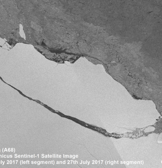
Icebergs: Does Loss Lead to Instability?
Published on 9 August 2017
Sentinel-2 captures coral bleaching of Great Barrier Reef
Published on 2 June 2017
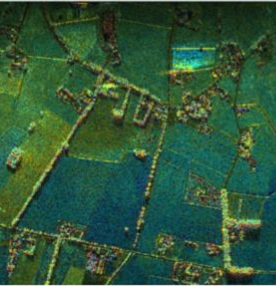
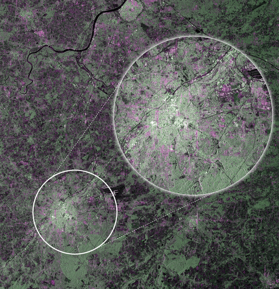
Joint ESA-BELSPO project "BelSAR" illustrates how tandem radar images can help map rural landscapes
Published on 7 March 2017