GAMES
|
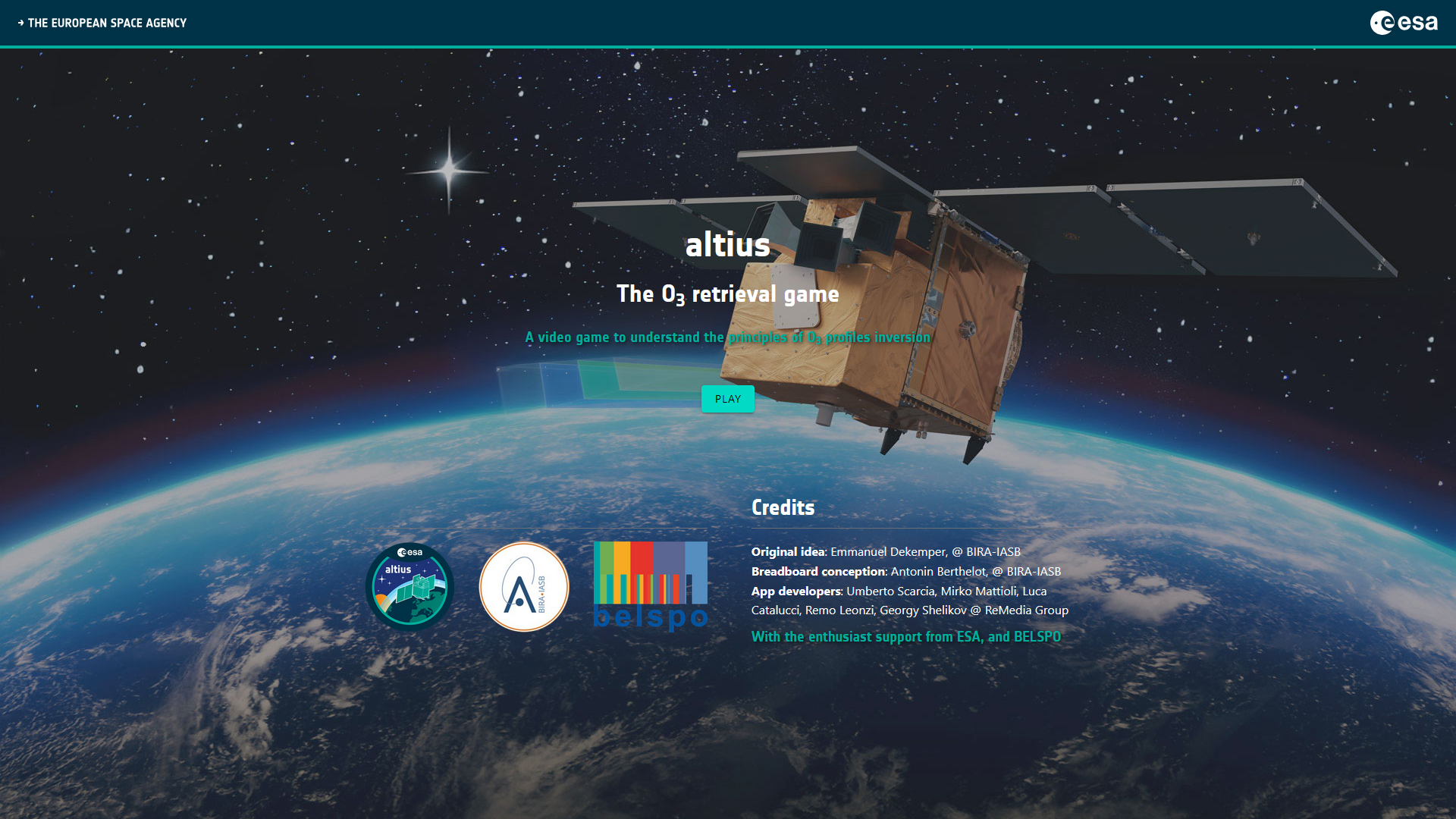
Altius - The O3 retrieval game
|
|
STEREO PROJECTS VIDEOS
STEREO PROGRAMME Watch these two videos below to discover in a few minutes what the STEREO programme is and get an overview of some applications covered by the research funded by the STEREO programme.
FEATURED VIDEOS
Among the news items published on this site, you'll find below commented satellite images, webstories explaining the why and how of STEREO projects, press articles and interviews of our researchers, and videos of our partners. Browse through them below by choosing the type of news or by selecting a tag. |
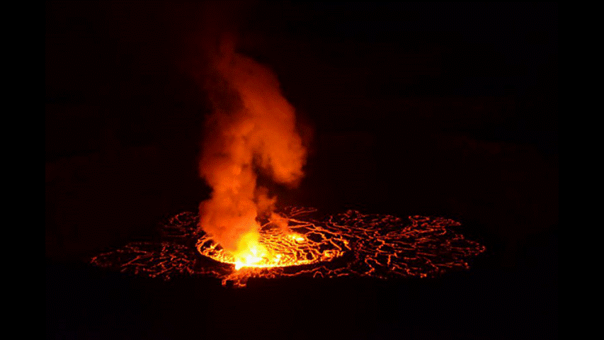

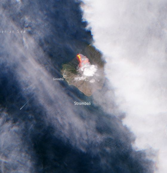
Italy’s Stromboli erupts
Published on 10 October 2022
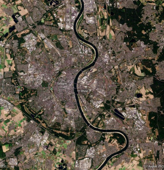
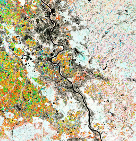
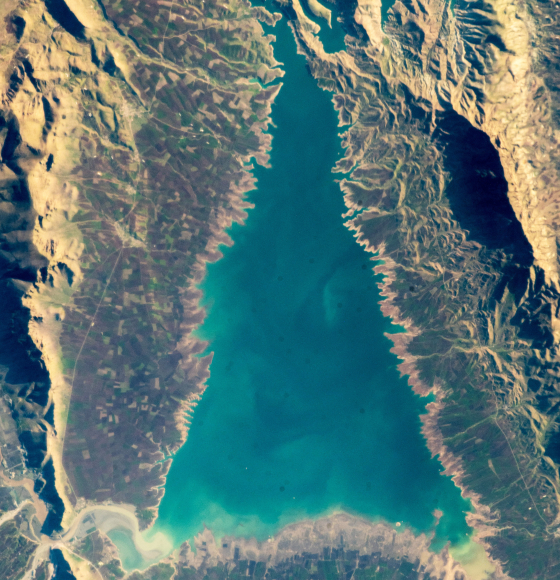
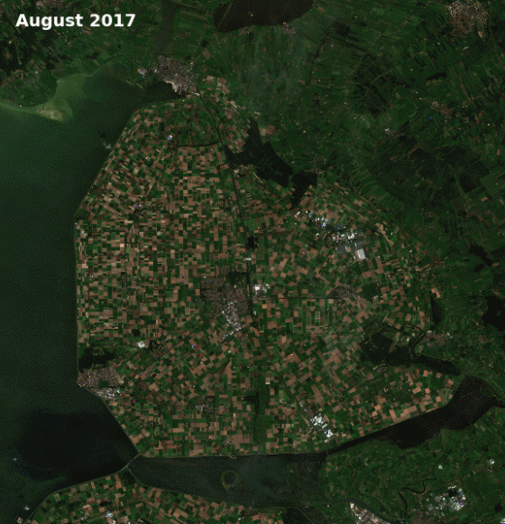
Rhine river runs dry
Published on 17 August 2022
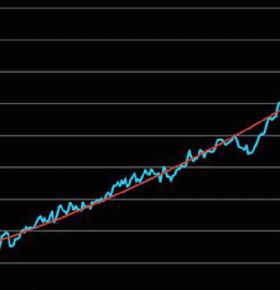
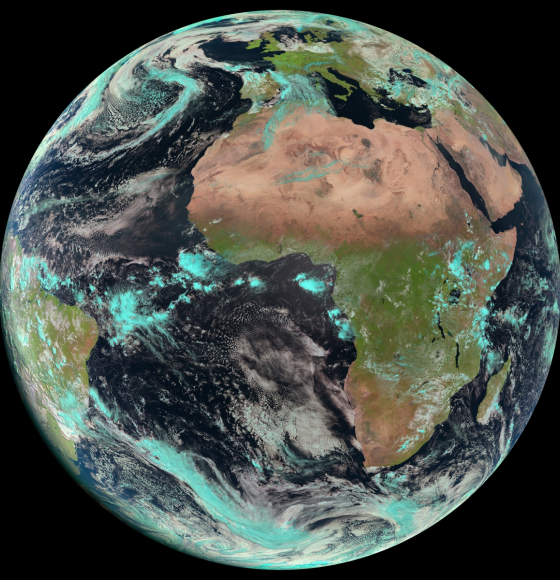
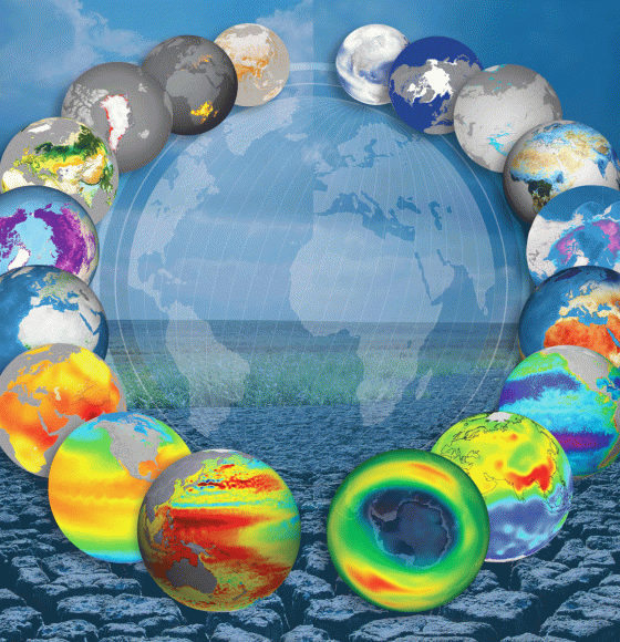
Climate change: the evidence from space
Published on 1 August 2022
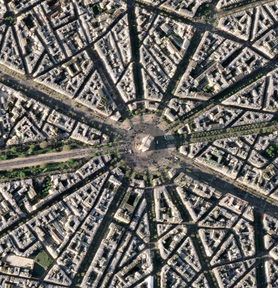
Earth from Space: Arc de Triomphe
Published on 16 May 2022
Rhine River, Germany
Published on 6 May 2022
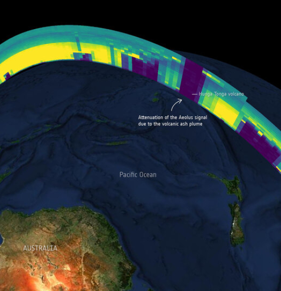
Keeper of the winds shines on
Published on 27 April 2022
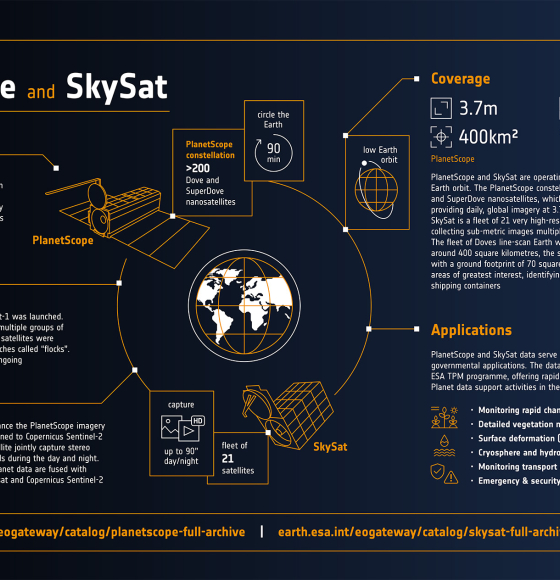
PlanetScope and SkySat infographic
Published on 26 April 2022
Key findings from the European State of the Climate Report
Published on 22 April 2022
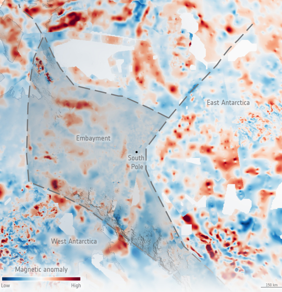
Filling the GOCE data gap unearths South Pole’s geological past
Published on 10 March 2022
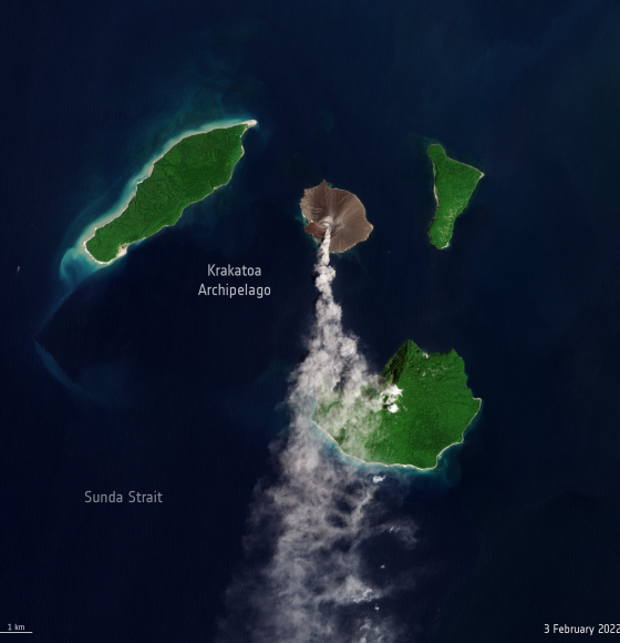
New eruption at Krakatoa Volcano
Published on 4 February 2022
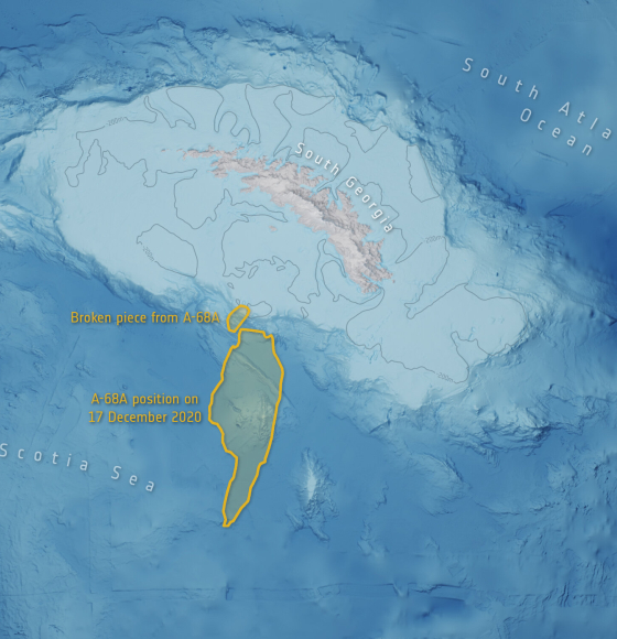
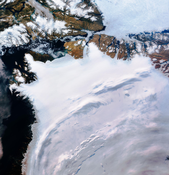
Mega iceberg released 152 billion tonnes of freshwater
Published on 21 January 2022
ESA and NASA launch revolutionary open-source platform
Published on 4 November 2021
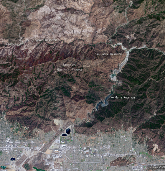
Stark reality of Californian drought from space
Published on 21 June 2021
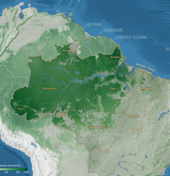
Forest degradation primary driver of carbon loss in the Brazilian Amazon
Published on 14 June 2021
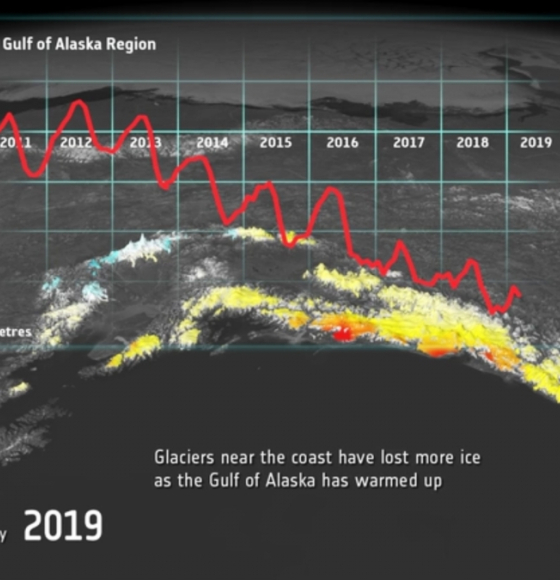
CryoSat reveals ice loss from glaciers in Alaska and Asia
Published on 1 June 2021
Teach with Earth educational webpage online
Published on 27 April 2021
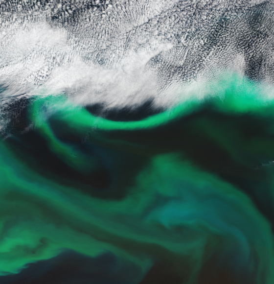
Swirling vortices of a carbon pump
Published on 11 February 2021
Exhibition 'Earth, the planet through the eyes of Thomas Pesquet and imagined by satellites'
Published on 28 September 2020
Tracking Sargassum seaweed invasions via satellite
Published on 5 August 2019
Understanding Climate change from space
Published on 13 May 2019
Best wishes from the International Space Station
Published on 21 December 2018
Satellites Safeguard Europe's Potato Industry
Published on 27 September 2018