Published on 26 April 2019
Forests are fundamental ecosystems. Not only are they of crucial economical, social and ecological importance, they play an essential role in the regulation of the climate as well. Forests cover 30% of the Earth's land surface and forest ecosystems are, soil included, the one-but-largest carbon sink on the planet, right after the oceans.
The quantification of biomass and carbons stocks in tropical forests has become an international priority in the implementation of REDD+ (Reduction of Emissions due to Deforestation and Degradation of forests).
But how to estimate biomass without cutting down trees? For aboveground biomass, traditional methods use size/mass correlations obtained on the one hand from post-logging volume estimates, and on the other by diameter and height measurements of studied trees. However, forest clearing is expensive and often impractical and/or undesirable. A team of researchers led by Dr. Kim Calders and Professor Hans Verbeeck of the University of Ghent, has therefore set about developing new methods for in-situ estimation of the three-dimensional structure and biomass of forests in order to validate biomass estimates produced on a larger scale through airborne or spaceborne imaging.
Their project, titled 3D-FOREST, is an exploratory research financed by the Belgian federal Science Policy Office for a duration of 3 years in partnership with Dr. Harm Bartholomeus and Professor Martin Herold of Wageningen University in the Netherlands.
 LiDAR (Light Detection And Ranging) data coming from different land- and air based platforms were collected in five tropical sites in Australia during a 2-month field campaign in the dry season to quantify aboveground biomass and forest structure.
The sites selected for the 3D-Forest project are part of of the Australian Terrestrial Ecosystem Research Network and offer excellent infrastructure such as towers and cranes, allowing measurements above the canopy.
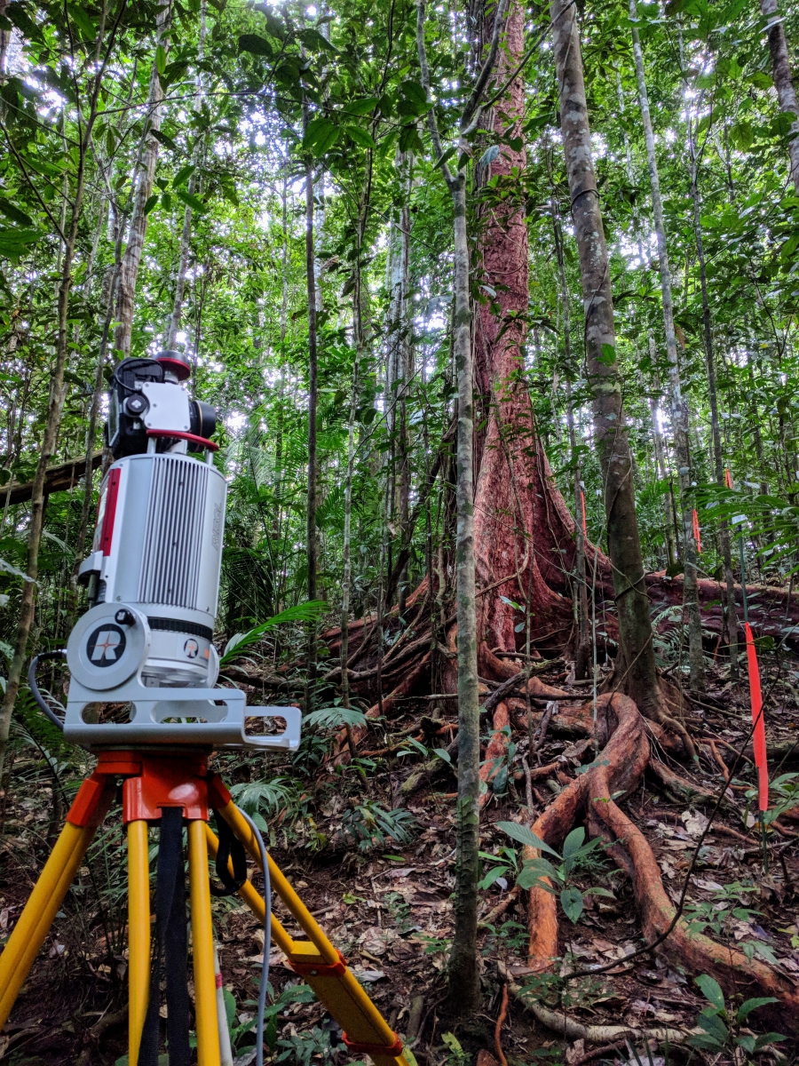
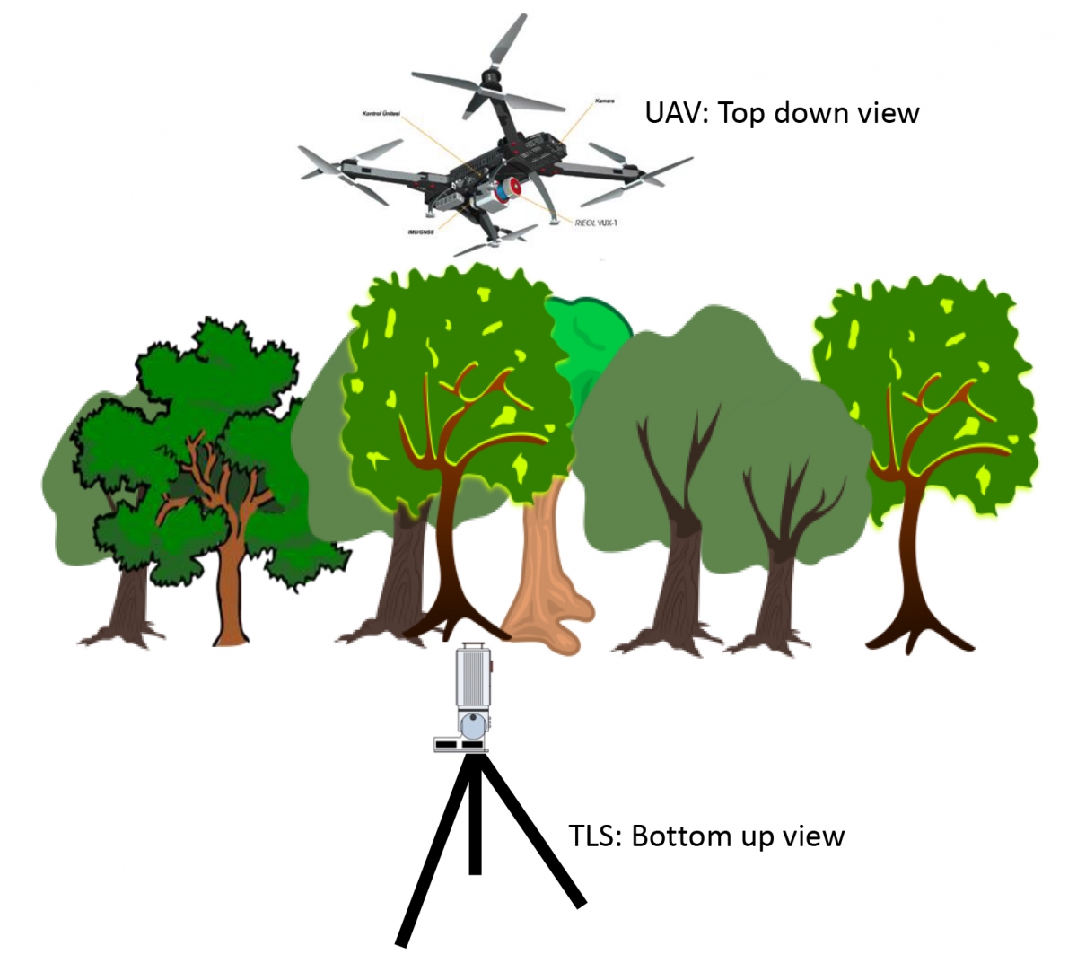
Terrestrial Laser Scanning (TLS) makes it possible to create 'virtual forests' with high level of detail, but limited spatial coverage. To widen that coverage, the TLS-technique needs to be supplemented with LiDAR data from drones (UAVs).
The combination of bottom-up and top-down data is expected to improve biomass estimates, as well as knowledge on how to transform plot-level measurements into landscape-level information.
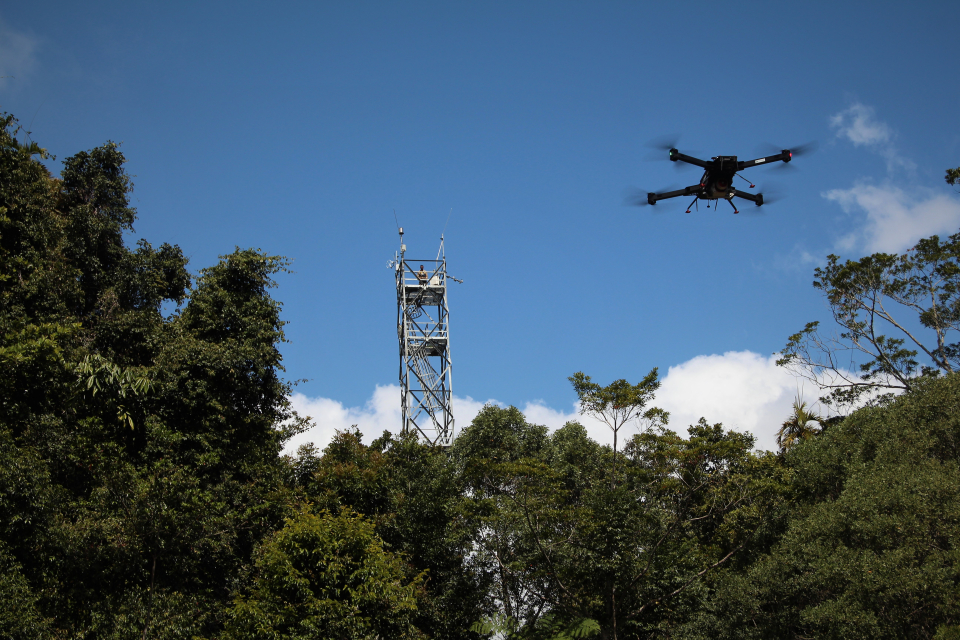
Tropical forests are challenging sites for launching UAVs that require sufficient free space in the canopy, as well as direct visibility during flight.