Published on 19 July 2024
How satellite remote sensing helps monitor the health of our planet
Meet Inge Jonckheere
Inge Jonckheere joined ESA in March of this year as the new Head of Green Solutions at the European Space Agency (ESA) in Frascati, Italy, where she leads the Science, Applications, Innovation, and Industrial Competitiveness’ sections of ESA.
She is passionate about using satellite data to study the state and dynamics of the world's nature, and how they are affected by climate change, human activities, and natural disasters.
She has a background in Earth observation and environmental engineering from the KU Leuven. Over the last 25 years, her professional activities focused on the use of satellite remote sensing (RS) to monitor natural resources, carbon stocks, biodiversity, and ecosystem services. The last 15 years she was Team leader of the RS team in the Forestry Department of the Food and Agriculture Organization (FAO) of the United Nations (UN) in Rome, Italy. With the team, she provided support to developing countries to better manage, monitor and protect their natural resources.
A key tool for monitoring our planet
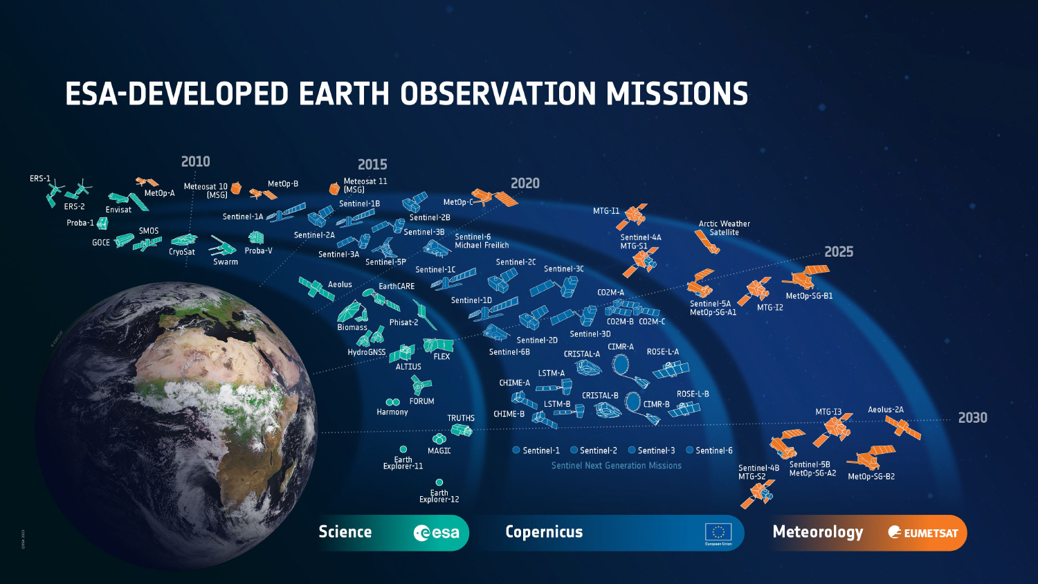
Nature is vital for the health of our planet, as it stores carbon, produce oxygen, regulates water cycles, and supports biodiversity. However, forests for example are under threat from deforestation, degradation, fires, pests, and diseases. Satellite RS can help track and assess the condition and changes of forests over time and space and provide early warnings of potential risks and impacts.For example, Inge and her team used satellite data from ESA's Sentinel-2 and Sentinel-3 missions to map forest cover and types, and to detect forest disturbances, such as fires, logging, and mining. They foresaw to use satellite data from ESA's BIOMASS mission, which will be launched in the coming years, to estimate forest biomass and carbon stocks, and to monitor forest dynamics, such as growth and mortality.
Unlocking the potential of satellite RS for natural resources’ monitoring
One of the main benefits of satellite RS for forest monitoring is the delivery of consistent, timely, and accurate information on scales ranging from local to global. This technology not only enhances ground-based observations and measurements but also supports decision-making and policy development for managing and conserving natural resources.
However, satellite RS also faces some challenges, such as the complexity and diversity of ecosystems, the influence of atmospheric conditions and cloud cover. Additionally, calibrating and validating satellite data with ground data is essential. In this context, Inge and her team worked closely with other scientists, stakeholders, and users to overcome these challenges and to improve the quality and usability of satellite data for global, national and regional monitoring.
What are the prospects?
Inge, along with other scientists, believes that satellite RS will remain crucial for planetary monitoring, especially with the advent of new technologies and methods. She hopes that this technology will not only raise awareness about the importance and urgency of nature protection and restoration but will also contribute significantly to achieving global goals for sustainable development and climate action, helping to curb climate change.
What are the plans of the Green Solutions Division and ESA?
ESA has recently developed the so called Earth Observation Strategy 2040. ESA Earth Observation programme has to implement thisstrategy in order to address the ESA Living Planet Challenges, and adapt to future revisions. The main objectives are to:
- Observe: Develop and provide observations to better understand the complexity of our planet and monitor its health.
- Understand: Enable improved predictions of the physical interaction between society and the Earth system.
- Decide: Inform decision-makers and citizens about the scenarios and consequences of political and economic decisions regarding our home planet.
ESA’s vision is to maximize the benefits of Earth observation for science, society, and economic growth in Europe, facilitated by European industry.
FutureEO Programme
FutureEO is a unique ESA programme that integrates science, technology, and applications, covering the entire mission life cycle, often exceeding original expectations. It prepares the technology and exploitation groundwork for operational EO missions, including meteorological missions and Sentinels.
EO Science for Society
EO Science for Society is a core activity of the EOEP-FutureEO-1 Segment 2 and is embedded in the Green Solutions Division. It combines Europe’s Earth science with other disciplines and emerging technologies to benefit society. Key principles include:
- Activities driven by scientific challenges, societal needs, and global agendas for maximum public good.
- Responding to needs and recommendations from scientific groups, operational user communities, and industries through systematic consultation and participation.
- Complementing and enhancing national programmes, Horizon Europe, DestinE, and Copernicus.
- Using cutting-edge technologies like AI, OpenEO platforms, Data Cubes, Cloud Computing, Big Data analysis, Open Science, and Citizen Science.
The ESA programme is designed to ensure scientific excellence, foster innovative applications, and enhance industrial competitiveness. By leveraging the latest technologies and maintaining a strong dialogue with the scientific community, this coordinated approach aims to maximize the societal impact and benefits of European Earth Observation assets.