Context and objectives
![]()
![]()
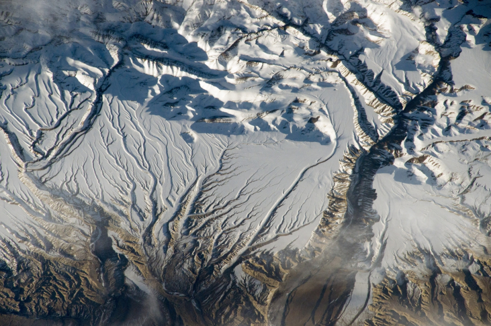
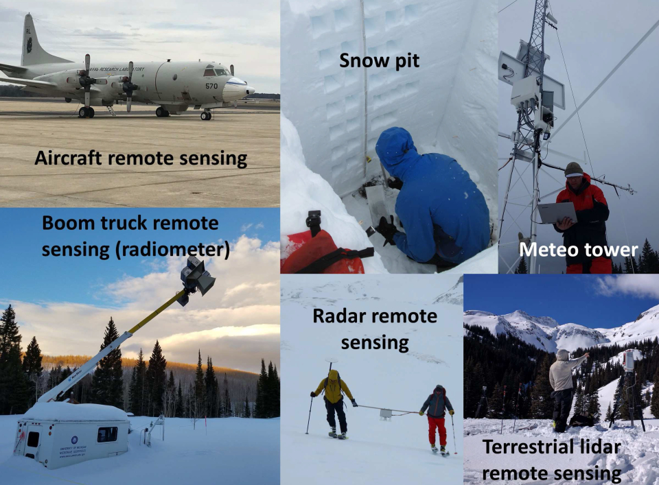
The biggest gap in our knowledge of the global surface water budget relates to snow. Remote sensing of snow water equivalents (SWE) has been notoriously difficult, especially in vegetated areas. Innovative concepts are needed to solve this problem. NASA has launched a multi-year airborne campaign, SnowEx, to collect a wealth of data over snow covered regions with varying vegetation densities. The first campaign was held in February 2017 in Grand Mesa, Colorado (US), a flat region with varying forest densities. The SNOPOST project used this unique dataset of airborne and terrestrial remote sensing data, and collaborated with the SnowEx team, to unlock the potential of remote sensing for snow estimation and prepare the next generation of snow scientists.
SNOPOST has three objectives:
- First, the spatial and temporal distribution of snow will be characterized based on remote sensing data and in situ SWE and snow depth observations, as well as using model simulations.
- Second, background model simulations will be merged with the multitude of remote sensing observations to estimate a posteriori SWE and snow depth, along with the uncertainty, by Bayesian inference.
- Finally, the sensors used in SnowEx will be objectively ranked based on their information content, i.e. reflecting their observation impact on a posteriori snow estimates. Ultimately, the sensor ranking and the stratification by physiographic indicators will serve as invaluable design recommendations for future spaceborne snow missions.
Project outcome
Scientific results
The KU Leuven team participated to the two intensive operation campaigns of NASA SnowEx at Grand Mesa, Colorado, US (2017 and 2020). The campaigns successfully collected a wealth of remote sensing and field measurements related to snow properties. SNOPOST has provided insight in the spatio-temporal distribution of the SnowEx measurements. We developed a novel technique that allows to unprecedentedly map the snow depth from ESA and Copernicus Sentinel-1 satellite observations at high spatial resolution in mountain ranges. The Sentinel-1 observations have been compared with SnowEx airborne LiDAR observations, ground measurements and land surface model simulations. A data assimilation framework was developed to optimally combine the model simulations and Sentinel-1 remote sensing observations. Results over Colorado and the European Alps show that the assimilation improves our knowledge on snowpack characteristics.
Societal (including environmental) relevance
The project has led to the development of an innovative technique to map snow depth in mountain ranges from satellite observations. Before, satellite-based snow depth observations were lacking in complex topography. The project furthermore demonstrated the value of assimilating this data into a land surface model. The novel data and methodological developments can potentially benefit a wide range of scientific fields (e.g., hydrology, cryosphere, water-energy-carbon cycle interactions, wildlife migration, etc.) and operational applications (e.g., water management, flood and avalanche prediction, hydropower generation, and numerical weather prediction).
Products and services
A new dataset: Sentinel-1 snow depth observations in mountains (available from the website of the accompanying BELSPO C-SNOW project: https://ees.kuleuven.be/project/c-snow)
Potential user
Space agencies (ESA, NASA), weather forecasting centers (ECMWF, Meteo-France), governmental organizations (WSL-SLF, ZAMG), hydropower companies, water managers, …
Outreach
SNOPOST: New methods for remote sensing of snow cover studied during NASA's SnowEx campaign
STEREO researcher goes on snow expedition along with NASA
Un chercheur STEREO part en expédition avec la NASA
STEREO-onderzoeker vertrekt samen met NASA op sneeuwexpeditie
C-SNOW live from the Rockies via Instagram
C-SNOW en direct des Rocheuses avec Instagram
C-SNOW live vanuit de Rockies via Instagram
STEREO researchers publish a method for measuring snow depth by satellite in Nature Communications
| Project leader(s): | KULeuven - Division of Soil and Water Management | |||
| International partner(s) |
|
|||
| Location: |
Country:
Region:
|
|||
| Related presentations: | ||||
| Website: | https://ees.kuleuven.be/project/snopost | |||