Published on 26 November 2021
The White Continent is the coldest, driest and windiest continent on Earth. Its 14 million km² are 98% covered in ice, that can be up to 4000 m thick. It is also the largest reserve of fresh water on our planet and the ocean that surrounds it not only harbours exceptional biodiversity but also plays a key role in the global climate system.
This ice giant has its feet in the water and its stability is threatened by global warming. If we fail to limit the temperature increase to 1.5 °, or even 2 ° C, by 2100, critical tipping points could be reached, forcing humanity to face a sea level rise that will completely disrupt the geographic distribution of the world's population.
Currently, the average sea level is rising at a high rate. For the period 2010 - 2019, it has reached 4.4 mm/year compared to 1.9 mm/year for the period 1971 - 2006. Almost half of this increase is due to the thermal expansion of the oceans. The share from melting glaciers and ice caps (Greenland and Antarctica) has already increased significantly in recent decades and future projections of mass loss indicate a much more dominant contribution of the two ice sheets to the global sea level budget.
The thinning of the Antarctic ice shelves and the corresponding decrease in stress on the interior ice flow are recognised as the main drivers of the current Antarctic ice loss (IPCC, 2013). This is particularly pronounced in West Antarctica, in response to increased oceanic heat transport under its floating ice shelf and resulting feedbacks, but data around Antarctica confirm that this effect is not geographically limited.

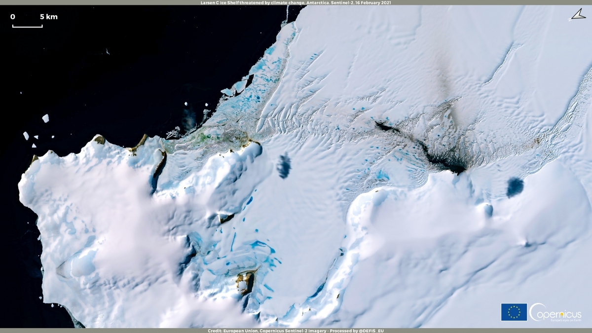
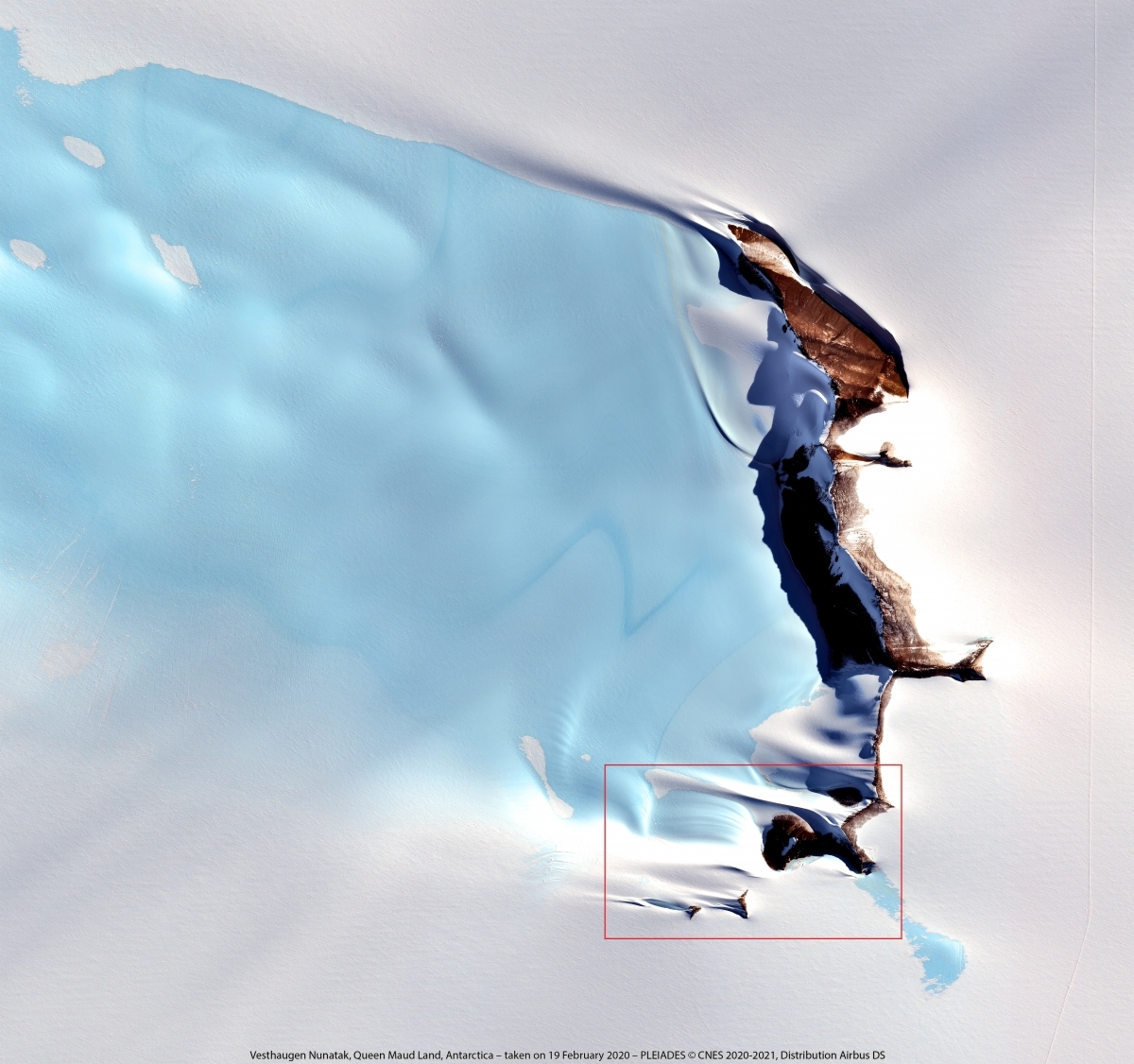
MIMO project: Detection of crack propagation and calving front from the 2017-2020 time series.
It is therefore imperative to modify our behavior to contain the warming. It is also fundamental to continuously monitor the state of the ice shelves surrounding Antarctica, as well as to improve our understanding of the mechanisms at play in their destabilization.
To study such vast and hostile environments, remote sensing is an essential tool. Several STEREO researchers have specialized in monitoring surfaces covered with ice or snow (see STEREO projects SNOPOST - Bayesian snow estimation under a vegetation gradient using SnowEx remote sensing data and C-SNOW - Observing the Northern Hemisphere snow mass with Sentinel-1) by means of radar satellite data.
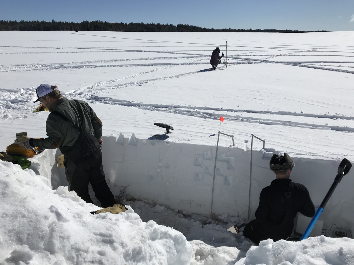
SNOPOST project: Detailed measurements of snowpack properties in a snow pit during the SnowEx2020 campaign.
The STEREO project MIMO (Monitoring melt where Ice Meets Ocean), led by Professor Frank Pattyn, aimed to quantify the basal melting of the ice shelves surrounding the Antarctic ice sheet at high spatial and temporal resolution in order to improve the modelling of the ice sheet. In particular, the project developed a method for automatic detection of ice shelf cracks and for monitoring the calving front (the boundary between an ice shelf and an iceberg).
The results obtained during the project constitute important advances in the understanding of the processes involved in the melting of Antarctic ice; they have also been used in the preparation of official documents, such as the recent IPCC AR6 report.
As part of another BELSPO-funded project – the BRAIN-be Mass2Ant project – 4 scientists, including Frank Pattyn, will fly to Antarctica this weekend for a mission of about a month, during which the researchers will carry out coring, surface snow analysis and radar measurements in order to better understand and predict the variability of the surface mass balance in East Antarctica. These data will be used to check whether the predictions of the climate models are accurate and, if so, to refine them.
More information
MIMO: Satellite data over Antarctica predict global climate change
SNOPOST: New methods for remote sensing of snow cover studied during NASA's SnowEx campaign
STEREO project C-SNOW (Observing the Northern Hemisphere snow mass with Sentinel-1)
Derrière les chiffres : 50 cm, la hausse minimale attendue du niveau des océans (RTBF)
Sea ice cover for October 2021 (Copernicus Climate Change Service)
Des scientifiques partent mesurer la masse de la calotte Antarctique (ULB)