Published on 15 October 2021
Private gardens are green spaces of great importance both for biodiversity and for the well-being of the inhabitants. In Flanders, for example, gardens occupy almost 10% of the total area of the region.
Because of their private nature, administrations wishing to promote greener policies had little information on the size, distribution or composition of gardens.
The team of the STEREO III project GARMON looked into this and was able to use various types of satellite and aerial data to draw up a map of the gardens, showing the extent, composition and configuration of the garden complex for the entire territory of Flanders.
Citizen science in support
A related STEREO project (type 'Dissemination and Support') named GARVAL has just been completed. Its main objective? To assess whether the garden map developed within GARMON can be validated by the citizens themselves, by introducing the information they have collected about their own garden via a collaborative exchange platform.
The project team therefore developed a tool including a drawing module allowing users to draw the contours of their garden as well as to delineate polygons of garden components (e.g. grass, shrub, tree, paving, pool) and launched the project "Je tuin intekenen en vergelijken" on the citizen science platform MijnTuinlab (My Garden lab).
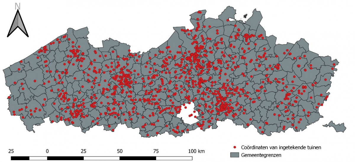
The project was enthusiastically received, as by the end of September the perimeters of more than 10,000 gardens had already been registered and for more than 1,100 gardens all the elements of the gardens had been digitised.
The collected information (garden outline polygons and garden components) was extracted from the MijnTuinlab data server and used to analyse the accuracy of the garden parcel and garden inventory maps created by GARMON.
Useful maps for administrations
The results are very positive: the correctness of the parcel map was estimated at 96.5% and the accuracy of the inventories is also high. In addition, the conclusions of the detailed comparison analysis highlight several elements that will allow the team to refine their method and produce even more detailed maps.
The valuable information derived from these 2 projects forms a solid basis to support policy initiatives in Flanders as well as several scientific projects (e.g. Leuven.cool or Curieuzeneuzen). The statistics derived from the garden map have already been designated as the official garden statistics of the Flemish government. In addition, the city of Leuven, in collaboration with the NGO Leuven2030, is planning to use the garden map as a basis to calculate the BAF (Biotope Area Factor) index, an indicator of the ecological value of the parcel, as part of their sustainability monitoring. Administrations within Brussels have also informally expressed their interest in the GARMONVAL approach.

The project to draw and compare your own garden is still going on, so if you live in Flanders and have a garden, don't hesitate to participate!
More information
GARMON: Mapping and characterizing gardens using remote sensing