Context and objectives
![]()
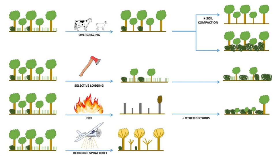
In the past, land use change assessments have mainly focussed on mapping conversion, dominantly from natural ecosystems to agriculture, and their associated environmental impacts. Objective measurements of the extent and severity of degradation are lacking for most parts of the world. This constitutes a major obstacle for assessing the connections between land use change and ecosystem functioning, including feedbacks between changes in vegetation composition and density, water use, and soil resources using processed-based models. The ReForCha project integrated multi-source remotely sensed data, field observations and land surface models to enhance the insights in ecosystem degradation in dryland forests.
Project outcome
Societal (including environmental) relevance
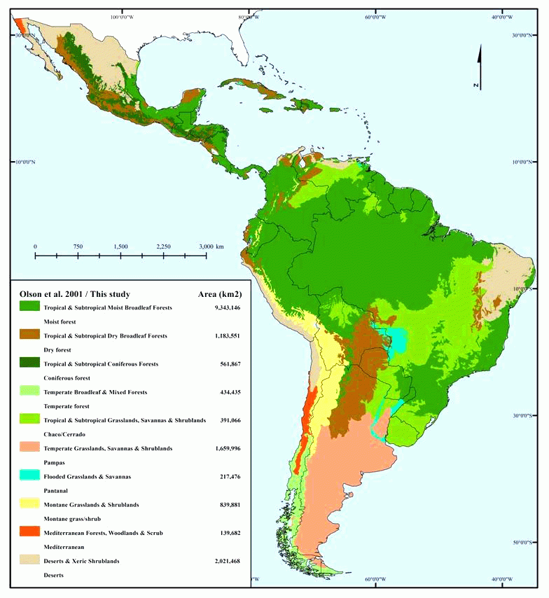
The regional assessment of soil salinity over the Dry Chaco provided unprecedented insights into the spatial pattern of primary and secondary salinity. By integrating soil salinity data with LSM output, satellite derived vegetation indices, and environmental data, we revealed how the sensitivity for soil salinization depends on climate, geomorphology, and land cover. Although our analysis of salinity focused on the central part of the Argentinean Dry Chaco, our approach and findings can be useful for other parts of the region or areas prone to soil salinization.
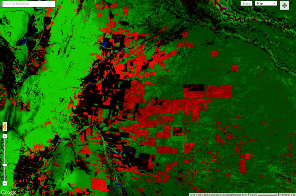
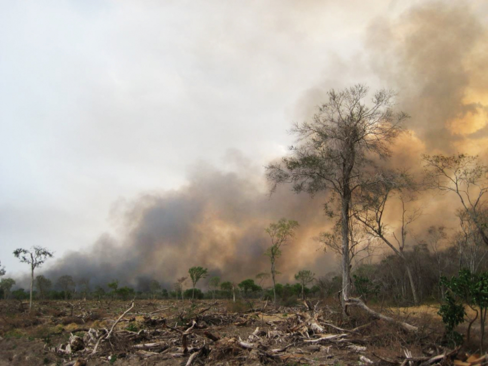
The maps of forest disturbance timing and agents in the Dry Chaco based on Landsat time series provides a robust assessment of forest degradation trajectories. The results show that 8% of the remaining forest has been affected by forest disturbances between 1990 and 2018, a process that is often overlooked in global deforestation hotspots. Forest-dependent people are widespread across the Chaco forests, and increasingly come into conflict with expanding commodity agriculture with about 18% of the homesteads disappearing between 1985 and 2015.
Products and services
- Map of forest disturbances timing in the Dry Chaco, based on multitemporal image analyses
- Map of forest disturbances agents in the Dry Chaco, based on multitemporal image analyses
- Map of salinity patterns in the Dry Chaco, based on field observations and spatial modelling
- Map of deforestation and postdeforestation land uses (pasture, cropland) 1985-2020
- Map of major archetypical frontier types
- Map of fractional tree and shrub cover
Extension of the Land Information System (LIS) modeling framework (source code)
Potential users
NGOs involved in conservation of Dry Chaco ecosystems: quantitative data on deforestation and forest degradation based on Landsat archives (1990-2018)
Governmental organisms: map of frontier types, maps of post-deforestation land uses
Governmental organisms, agricultural sector and agribusiness: map of salinity patterns
Scientific community: source code for dynamic LSM simulations taking land cover change into account
Outreach
Preserving life with spatial data

| Project leader(s): | UCL - Earth and Life Institute, Climate | |||||
| Belgian partner(s) |
|
|||||
| Location: |
Continent:
Country:
Region:
|
|||||
| Related presentations: | ||||||
| Website: | http://www.climate.be/reforcha | |||||