Data acquisition


Getting into orbit
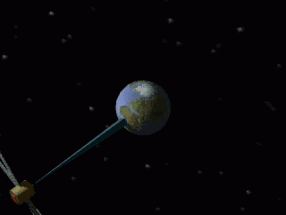
To make satellite observations possible, the viewer must be positioned in an orbit around the Earth. The satellite's orbit will depend on what one wishes to observe and how.
When launched, the satellite must attain enough speed to reach and maintain the right orbit around the Earth. If its speed is not enough, it will assume a spiralling orbit, coming ever closer to Earth until it finally falls back into the atmosphere. If the speed is too great, the opposite happens: the satellite will spiral every further away from the Earth. Ultimately, it will escape Earth's gravitational system altogether. One intentionally applies this technique when launching space probes to study other planets or the sun.
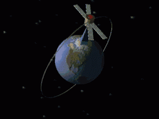
The inclination (or orbital angle) is the angle between the orbital plane and the plane of the equator. This angle determines what area on earth will be observed by the sensor aboard the satellite. A satellite with an inclination of 50° will only cover an observation area between 50°NL and 50°SL. Thus, if one wishes to cover the entire planet with a single satellite, the inclination must amount to 90°.
Depending on the orbit around the Earth, one speaks of a geostationary, a polar, direct or retrograde satellite.
A geostationary satellite is one which is always located above the same spot on Earth. To achieve this, the satellite must revolve in a circular orbit around the Earth with an orbital glide velocity equal to the Earth's rotation. This occurs in the plane of the equator at a distance of around 35,890 km from the Earth's surface. The time of revolution of these satellites is the same as that of the Earth. Telecommunication satellites are generally geostationary.
Other satellites do not remain suspended above a fixed point on Earth. The plane of their orbit forms an angle with the plane of the equator. They can move in a polar (over the poles), direct (inclination between 0 and 90°, whereby they move eastward) or retrograde (inclination between 90° and 180°, westward movement) orbit.
SPOT, for example is a polar satellite. A single revolution of SPOT takes 101 minutes, thus 101 minutes later it once again crosses the same degree of latitude. In the meantime, however, the earth has revolved further to the east. Thus it takes several days before it will once again fly over the same place. With SPOT, this period is 370 revolutions x 101 minutes = 26 days. Moreover, each time they fly over the same area at around the same hour: for example, SPOT always flies over Belgium at about 11 a.m. In this way, one can monitor seasonal variations at regular intervals.
A heliosynchronous satellite is one whose orbital plane always forms a constant angle with the earth-sun line. To achieve this, each day one must shift the orbit of the satellite around 1° (= 360°/365.25 ) to the east. After one year, the satellite once again finds itself above the same point. One thus compensates for the effect of the Earth's revolution around the sun.