Radar


It is important to distinguish active sensors from passive sensors. A passive sensor measures the radiation transmitted or reflected by a feature on Earth. An active sensor sends out an electromagnetic signal to illuminate the terrain and records or measures the response from the target or surface. Active sensors are independent of the sun and solar conditions and can operate 24 hours a day.
One of the best known active sensors is RADAR. Radar is an acronym for RAdio Detection And Ranging. Radar operates in the microwave portion of the electromagnetic spectrum beyond the visible and thermal infrared regions.
The scene to be "photographed" is thus illuminated with not light, but microwave radiation. Microwave images provide information about the geometric and dielectric properties of the target studied. These relate mainly to the target’s roughness and composition (iron, concrete, wood, moisture content), which makes radar images more difficult to interpret than optical images.
In general, imaging radar uses wavelengths from 1 mm to 1 meter. Longer wavelengths (lower frequencies) are generally for purposes such as communication and navigation. Operating in the microwave region of the electromagnetic spectrum improves signal penetration (decreases attenuation) of the atmosphere. Contrary to optical sensors, imaging radar is not affected by cloud cover or haze and is fairly insensitive to weather conditions. Water clouds affect radar operating at wavelengths below 2 cm only, while the effects of rain are relatively inconsequential at wavelengths over 4 cm.
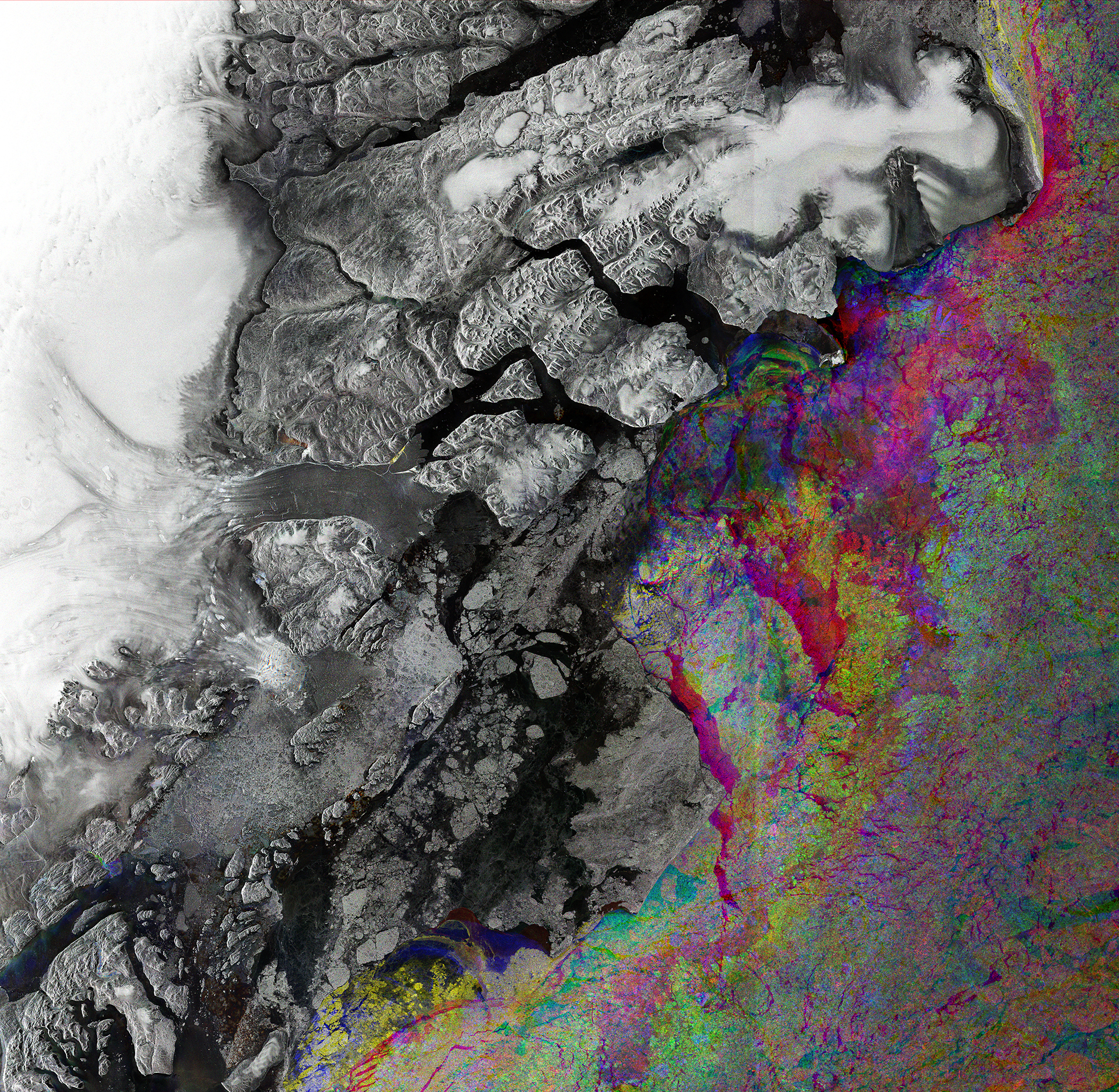
Zachariae glacier. This image taken over part of northeast Greenland’s coast combines three images from Sentinel-1A’s radar on 15 February, 10 March and 3 April 2016. The shades of grey on the left side of the image depict the static landmass, while the colours on the right show changes in sea-ice type and cover between the three radar scans. Source: ESA
Imaging radars operate at a specific wavelength. Whereas optical sensors record electromagnetic energy in bands that encompass a range of wavelengths (e.g., 0.4-0.5 micrometers), a radar system records the signal response from the ground or target at a single, specific wavelength (e.g., 23 cm). To take the comparison farther, the visible part of the electromagnetic spectrum can be said to include the red, green, and blue spectral regions. Similarly, the active microwave region includes X, C, L, and K bands, among others, that refer to specific segments of the microwave portions of the electromagnetic spectrum. For instance an “X” band system would be a radar operated at a single wavelength within this band (e.g., 3.2 cm). This alphabetic reference to radar wavelength was first established by the military in the early days of radar research for exploration operations. Over time several other identification schemes have been suggested and employed by other governments and scientists. However, the assignment of letters to microwave frequency regions has been adopted as the de facto, if not official, wavelength reference system for radar.
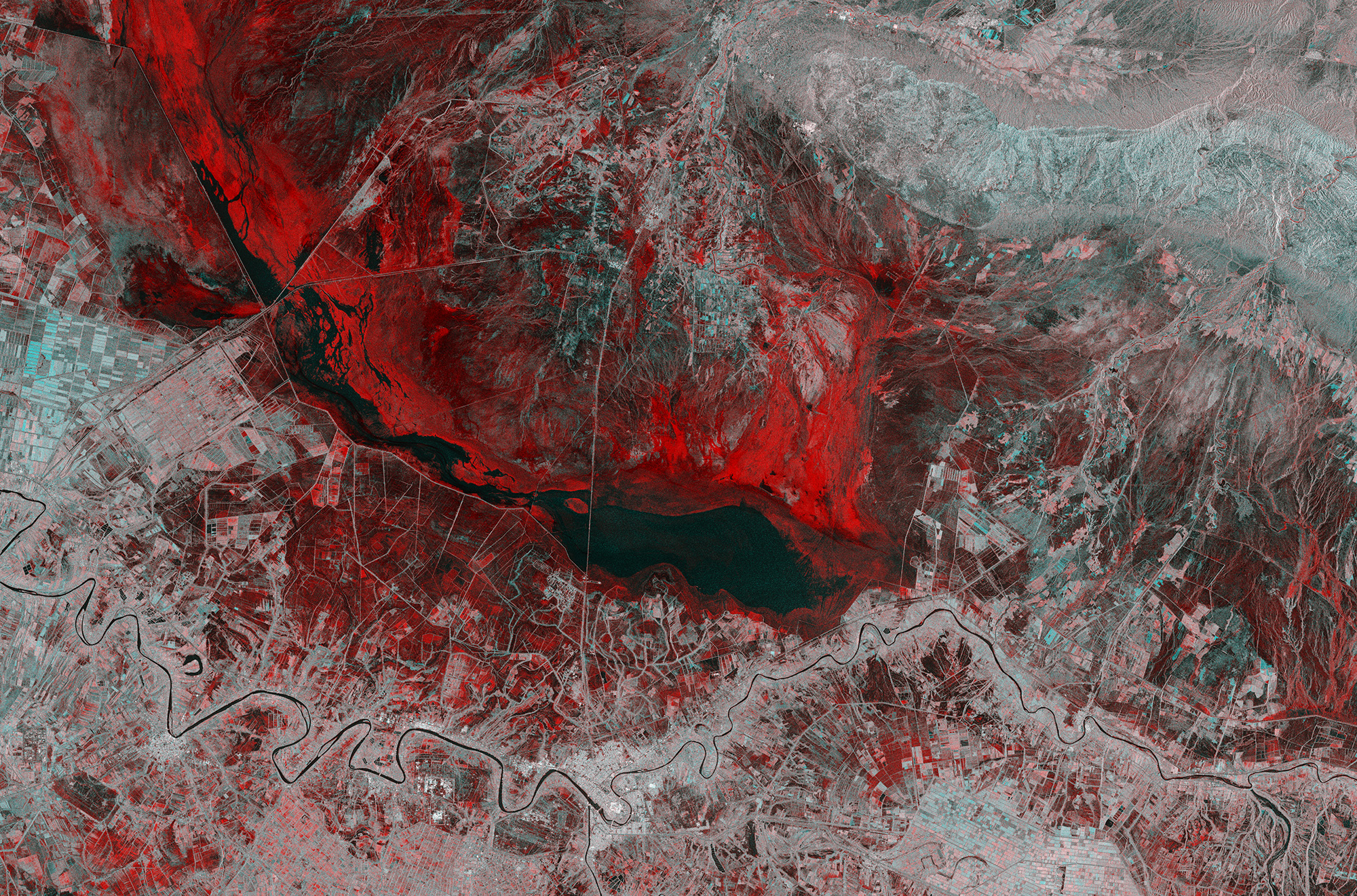
This Copernicus Sentinel-1 image combines two acquisitions over the same area of eastern Iraq, one from 14 November 2018 before heavy rains fell and one from 26 November 2018 after the storms. The image reveals the extent of flash flooding in red, near the town of Al-Kūt. Source: ESA
Radar has a variety of characteristics valuable to geoscientists. Perhaps the two most notable are its above-mentioned weather independence and 24-hour operation. Radar also provides a unique perspective of the landscape and many unique opportunities for quantitative terrain analysis. Several features have been advertised and used in operational systems. Some were initially oversold, whereas others, although under-developed at present, may provide the keys to the operational imaging radar systems of the future.