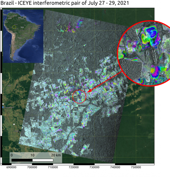
Actualités
Vous êtes ici
Events and timed opportunities
GEO BON Global Conference: Monitoring Biodiversity for...
Running from 10 octobre to 13 octobre 2023
PhD Fellowship in crop water stress monitoring using...
SPHERES Research Unit, Université de Liège and the Earth and Life Institute, Université Catholique de Louvain
Deadline 15 octobre 2023
Formation RSAT II - Utilisation de la télédétection en...
Running from 2 octobre to 6 novembre 2023
Deadline 13 novembre 2023
EC-ESA joint workshop: "Science for a Green and...
Running from 22 novembre to 24 novembre 2023

Tracking the world’s forests from space
Publié le 31 août 2023

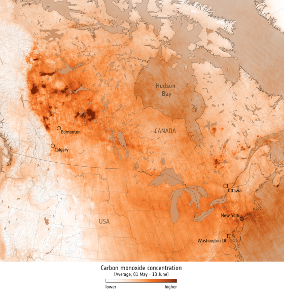
Carbon monoxide from fires in Canada
Publié le 15 juin 2023

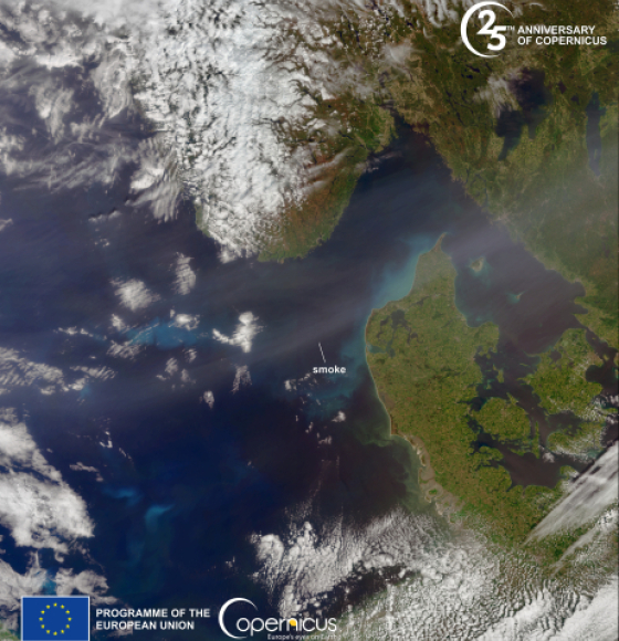
Smoke from Canada wildfires reaches Europe
Publié le 27 mai 2023

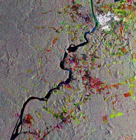
ECTIC: Suivi des changements environnementaux à l'aide de la constellation ICEYE
Publié le 12 mai 2023

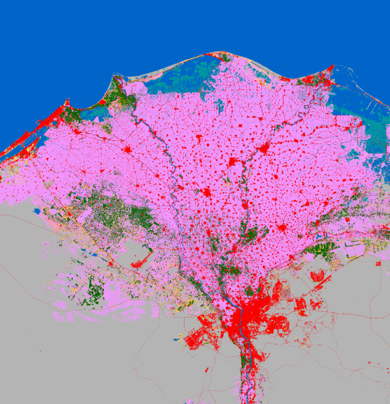
Meet ESA WorldCover – Global Land Cover mapping at High Spatial Resolution
Publié le 17 mars 2023

Recovering forests regain a quarter of carbon lost from deforestation
Publié le 16 mars 2023

Earth from Space: The Triple Frontier
Publié le 24 février 2023

How Nepal Regenerated Its Forests
Publié le 9 février 2023

Les résultats de MAMAFOREST font la couverture de Nature Plants
Publié le 20 octobre 2022

A new disastrous wildfire is raging in the southwest of France
Publié le 12 août 2022

Wildfires Continue to Burn Across New Mexico
Publié le 4 mai 2022

ALBERI : Comment les arbres affectent-ils l'atmosphère terrestre en cas de sécheresse ?
Publié le 21 mars 2022

Peak of deforestation in Brazil
Publié le 25 novembre 2021

ESA and NASA launch revolutionary open-source platform
Publié le 4 novembre 2021

KNP Complex fire in California threatens giant sequoias
Publié le 20 septembre 2021

California continues to burn
Publié le 16 septembre 2021


Wildfire in Evia, Greece
Publié le 12 août 2021

Satellites reveal how forests increase cloud and cool climate
Publié le 6 août 2021

How satellites save mangroves from space
Publié le 26 juillet 2021

Forest degradation primary driver of carbon loss in the Brazilian Amazon
Publié le 14 juin 2021


Journée internationale des forêts
Publié le 19 mars 2021

Characterising Termite Mounds in a Tropical Savanna with UAV Laser Scanning
Publié le 19 mars 2021

ESA's Earth from Space: Amazon rainforest
Publié le 19 mars 2021

Monitoring atmospheric gasses during wildfires
Publié le 12 novembre 2020

Assessing California Fire Scars
Publié le 16 octobre 2020

New satellite images to allow anyone, anywhere, to monitor tropical deforestation
Publié le 13 octobre 2020

RiReMo: Les bandes riveraines vues d'en haut
Publié le 24 septembre 2020

Mapping the Roots of Mangrove Loss
Publié le 26 août 2020

Des données spatiales pour préserver la vie
Publié le 3 mars 2020

Sentinel-1 captures Mato Grosso
Publié le 6 décembre 2019

MAMAFOREST: la gestion des mangroves grâce aux satellites
Publié le 5 novembre 2019

Meeting of Waters
Publié le 3 octobre 2019

Sentinel-2 Captures Australian Bushfires
Publié le 16 septembre 2019

Amazon Rainforest wildfires
Publié le 3 septembre 2019

NASA's ECOSTRESS Detects Amazon Fires from Space
Publié le 2 septembre 2019

L'Amazonie en feu
Publié le 23 août 2019

Fire races across Gran Canaria
Publié le 23 août 2019

Palm Oil Plantations on Borneo
Publié le 24 juillet 2019

3D-FOREST: Mieux connaître les forêts tropicales grâce au LiDAR
Publié le 26 avril 2019

Human Activity in China and India Dominates the Greening of Earth
Publié le 15 février 2019

OpenForests launches the forest project platform explorer.land
Publié le 7 novembre 2018

Satellites help scientists see forests for the trees amid climate change
Publié le 24 novembre 2016

Journée mondiale de l'Environnement
Publié le 3 juin 2010