News
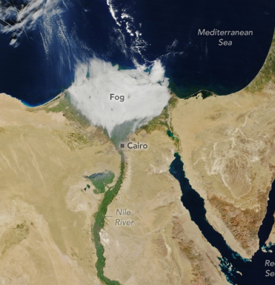
Foggy Nile
Publié le 10 janvier 2024
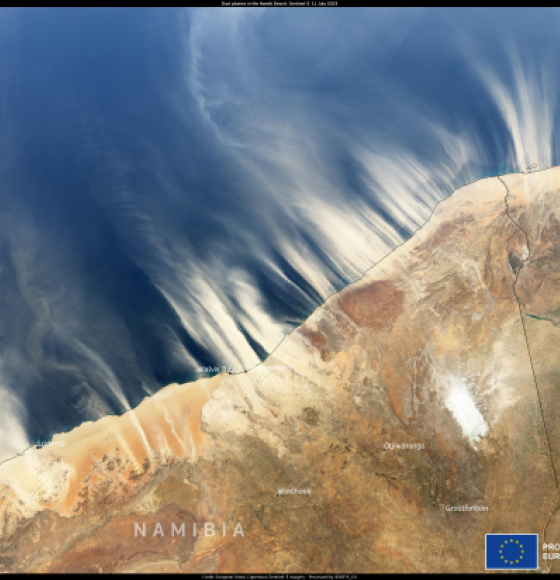
Multiple plumes of dust and sand from the Namib desert
Publié le 19 juillet 2023
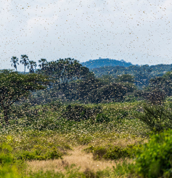
Desert Locust Monitoring in East Africa
Publié le 31 mai 2023
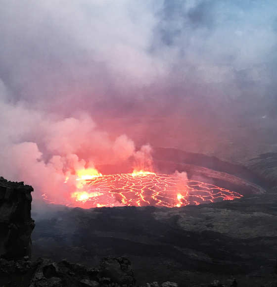
VERSUS : Observer l’intérieur des volcans grâce à la télédétection
Publié le 17 mars 2023
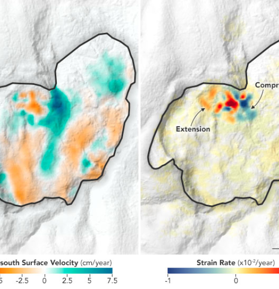
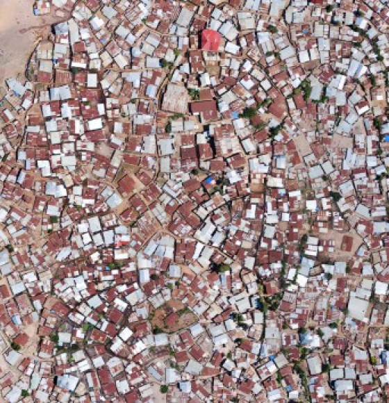
Landslide Creeping Below an African City
Publié le 7 février 2023
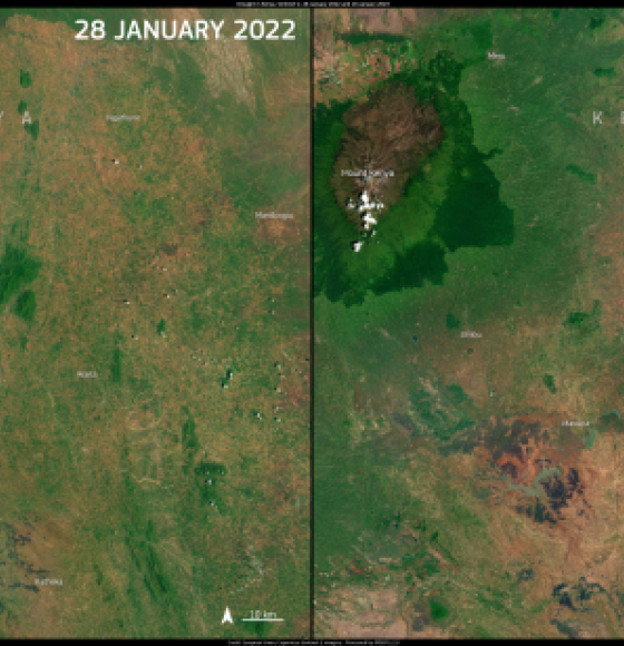
Worst drought in 70 years hits the Horn of Africa
Publié le 1 février 2023
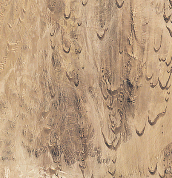
Racing Dunes in Namibia
Publié le 9 janvier 2023
The MODUS project team makes the cover of Nature Geoscience
Publié le 8 décembre 2022
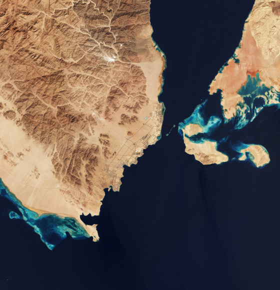
Sharm El-Sheikh, Egypt, host city to the COP27
Publié le 18 novembre 2022
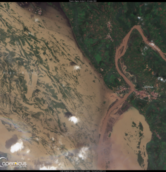
Disastrous floods affect Nigeria
Publié le 17 octobre 2022