II- WHAT INSTRUMENTS ARE USED FOR OBSERVATION?
1. THE DIFFERENT PLATFORMS
In order to obtain useful information about a particular object or surface from a distance, it is necessary to record the radiation that reflects or emits from that surface. The instruments that make such recordings possible, the sensors, must be installed on stable supports or platforms, which are usually located far from the observed surface. Hence the term ‘remote sensing’: observing from a distance. These platforms can be on the ground (for example mounted on cranes or in towers or buildings), but they are usually in the air (balloons, aeroplanes or drones) or in space (satellites, space stations or spacecraft).
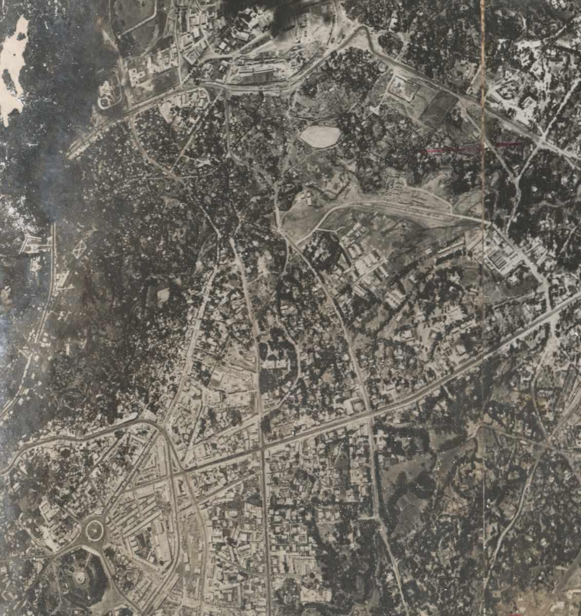
Historically speaking, remote sensing began in the early twentieth century with the first aerial photographs, which became possible thanks to the rapid progress of photography and aviation from the second half of the nineteenth century.
Aerial photography grew rapidly during the First World War, when it was used to gather information about enemy positions and activities (e.g. hidden trenches).
The few hundred experimental aerial photographs that were taken during the first six months of the war grew to more than five million images during the first nine months of 1918.
After the war, people realised the commercial and scientific importance of aerial photography and the first aerial photography companies were founded in the interwar period.
During the Second World War, Kodak worked with the American army to develop the so-called Aerochrome infrared film. This ‘camouflage film’ was used to take photos in which green and red objects appeared blue and green respectively, while objects that reflected infrared light were depicted as red. Natural vegetation, which reflects infrared light very strongly, was thus easily distinguished from army vehicles camouflaged in green.
Aerial espionage became essential. After the Second World War, the use of remote sensing for espionage continued. During the Cold War, however, there was a shift from the use of spy planes to satellites, partly due to the improvement of anti-aircraft defence. For example, the American army accelerated their Corona spy satellite programme because in 1960 a U-2 spy plane was shot down over the Soviet Union.

Aerial photograph of Addis Ababa, Ethiopia. Taken on 24 February 1938 on behalf of the Italian army during the Italian occupation of Ethiopia. Source: Nyssen, J. et al., 2020. Dataset: aerial photographs of Ethiopia 1935-1941. Ghent University, Department of Geography; Mekelle University, Institute of Geoinformation and Earth Observation Sciences; Ethiopian Geospatial Information Institute. http://www.ethiopia1935.ugent.be DOI requested.
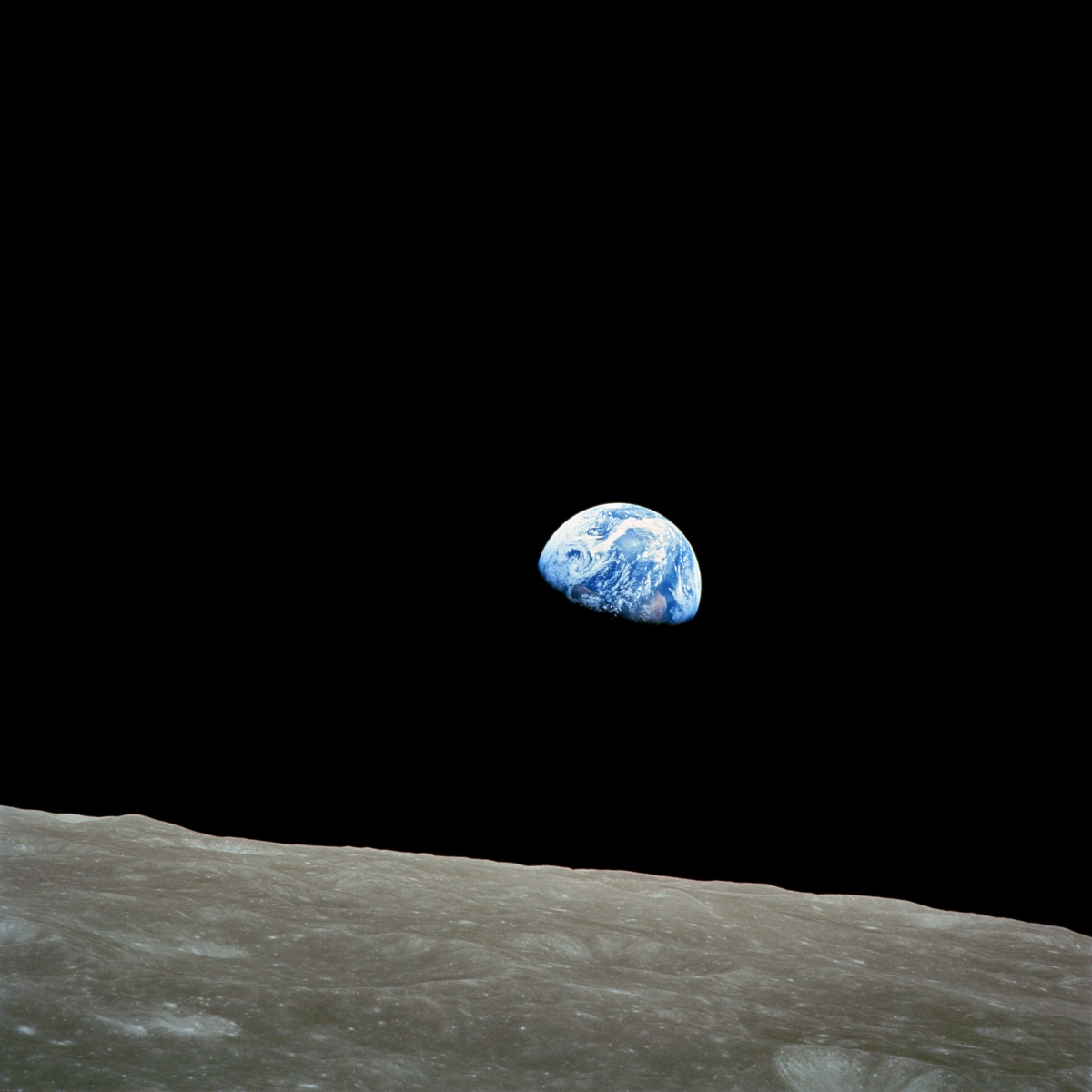
The space race and the first manned space flights provided the first ‘peaceful’ images of the earth. The iconic photo ‘Earthrise’, taken on Christmas Eve 1968 by Bill Anders aboard the Apollo 8, is one of the most influential environmental photos which, according to some, kick-started the environmental movement in the 70s.
Earthrise. Source: NASA / Bill Anders.
From the very first manned space missions, the idea arose of using the exceptional vantage point of a satellite orbiting the Earth to take constant photographs of the Earth. This quickly led to the launch of the first civilian Earth observation satellite, Landsat, in 1972.
The Landsat programme continues to this day with the launch of Landsat 9 on 27 September 2021. Over the years, the American Landsat satellites have also been joined by their counterparts from other countries, including the European Sentinel satellites and commercial satellites.


