IV - FROM DATA TO INFORMATION
1- PREPARE AN ANALYSIS (PRE-PROCESSING)
1.1- Radiometric and atmospheric correction and calibration
An ideal earth observation system should be equipped with a perfect spectroradiometer, which precisely and uniformly measures the amount of reflected energy from the Earth's surface.
Unfortunately, sunlight is distorted in the atmosphere and does not illuminate all objects at the same angle. Moreover, distortions also arise from the electronic processing of the radiation captured by the sensors. As a result, the radiometric values from Earth observation satellites do not match values that would be measured in the field.
Radiometric calibration makes it possible to convert the recorded sensor voltages or digital numbers (DN) to physical quantities (radiation or reflectance) in an absolute scale. This is necessary to obtain interpretable, accurate and consistent observations of the environment and climate.
An initial calibration is done before launch, in stable and controlled laboratory conditions at the manufacturer's premises. However, because sensors on board satellites are constantly exposed to a harsh space environment, they degrade over time. Therefore, most satellites today have onboard devices that perform calibration routinely.
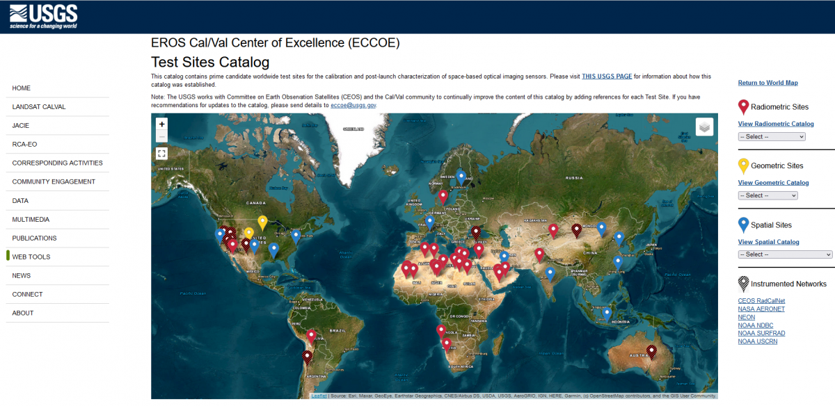
USGS catalogue of calibration/validation sites for post-launch calibration and characterisation of optical image sensors in space
In addition, it is also possible to use so-called "pseudo-invariant" sites to monitor the performance of the sensor over time. These are reference sites on the Earth's surface with a known radiometric profile, which are spatially uniform and change little over time, such as open water surfaces, ice caps or extensive sand plains (e.g. some parts of the Sahara or Bolivia).
After radiometric calibration, the pixel values can be converted to spectral radiation as observed at the top of the atmosphere using simple transformation formulas. This spectral radiation is expressed in Watts per square metre per steradian per micrometre wavelength ( W/m2srμm). We can then use that value to calculate the spectral reflectance at the top of the atmosphere. This represents the ratio of the amount of radiation reflected from a given surface within a given wavelength to the radiation from the sun that theoretically landed on that surface during the recording.
 Even after radiometric correction has taken place, radiation values coming from satellite sensors will not match values we would measure in the field itself. This is because the light reflected from objects on the Earth's surface also has to pass through the atmosphere before the satellite's sensor registers it.
Although the wavelengths used in optical remote sensing are located in so-called "atmospheric windows" (see Sources of radiation), their interaction with the atmosphere still disturbs the signal. These disturbances are due to the presence of gases and dust aerosols, which can absorb and/or deflect certain wavelengths (called scattering), altering the spectral properties of the radiation.
There is also the issue of clouds, which can almost completely hide the Earth's surface from the optical sensor. To automatically mask or indicate clouds and their shadows on image products, various detection algorithms are used. The probability that the pixels of image products with coarse spatial resolution such as MODIS contain clouds somewhere is relatively high. Therefore, temporal composites are created by combining daily observations into weekly or monthly ones. Various algorithms have also been developed for higher spatial resolution images to deal with clouds.
To correct atmospheric perturbation, there are roughly two approaches. A first technique requires knowing the composition of the atmospheric column (e.g. total water vapour, aerosols). These data can come from other sensors or sources, or they can be determined from atmospheric models (e.g. MODTRAN).
STEREO researchers have developed a reconstruction tool to fill gaps, due to clouds, for example, in geophysical time series such as ocean temperature (see EOF-based Time Series Reconstructor on the STEREO Toolbox page). The tool was applied to sea surface temperature in the infrared over the western Mediterranean: left, the original image, right, the processed image.
A second approach relies solely on the image itself. This involves algorithms using automatically selected reference points in the image or by performing calculations based on the observed radiation in specially provided spectral channels. An example of such methods is the sen2cor algorithm used for atmospheric correction of Sentinel-2 images. For this, it uses, among others, band 1 (443 nm - for aerosols), band 9 (945 nm - for water vapour) and band 10 (1375 nm - for detection of cirrus clouds).


