VI - INTEGRATION WITH OTHER DATA
2 - MODELLING
To better understand and predict various natural processes, scientists use computer models. For example, a hydrological precipitation-discharge model can model the surface runoff of water after a rainstorm in a river basin, informing decision-makers about measures they can take against flooding.
In turn, other models are capable of simulating land-use change and urban growth using different planning scenarios, economic forecasts and demographic data.
Of course, there are climate models that try to predict changes in temperature and precipitation patterns.

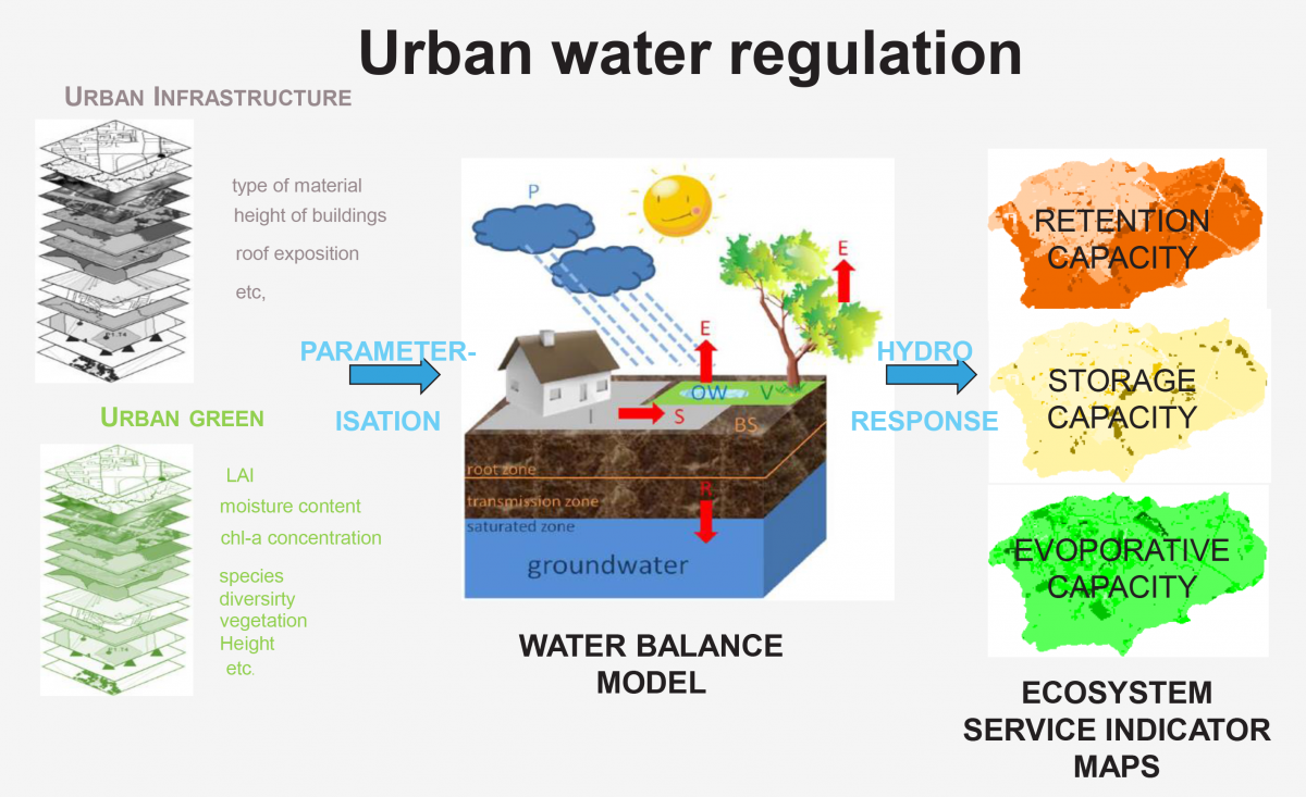
Urbanisation has a major impact on water resources because of the increase in paved surfaces in the flow area of a river. Precipitation in urbanised areas cannot infiltrate slowly into the soil due to this paving and consequently flows rapidly through the sewer system into the river. The relative hardening of a river basin and the spatial distribution of hardening therefore help determine the risk of flooding after heavy rainfall. Satellite imagery, by applying appropriate classification techniques, can be used to produce land cover maps at regular intervals showing artificial pavements (roads, car parks, buildings...) and green infrastructure within a catchment. These data can be used to better parameterise hydrological models so that they can alert us to peak flows with higher accuracy. Source: STEREO III project URBANEARS (Urban Ecosystem Analysis supported by Remote sensing)
All the above examples and many more models use remote sensing data for parameterisation, calibration and validation. Remote sensing is thus a very important data source to better understand our planet, anticipate changes and better protect humans.
