

III - WHAT IS A DIGITAL IMAGE?
1- IMAGE OR DATA TYPES
1.1- Optical images
The term "optical" refers to the wavelength range in the electromagnetic spectrum where lenses and mirrors can refract or reflect energy. It thus refers to radiation between 0.3 and 14 micrometres, which includes ultraviolet, visible and infrared light. Optical remote sensing images thus reflect the intensity of radiation in this wavelength range, observed by detectors at locations on the Earth's surface that correspond to the pixel locations in the image.
Images taken by sensors used for remote sensing typically have several image channels, each representing the intensity of radiation in a particular wavelength range. This can be the red, green and blue light, just as in a normal digital camera, but equally other parts of the spectrum such as the infrared. We call such images multispectral because they contain information across several separate wavelength ranges or spectral bands. If very many image channels are present, each representing a narrow band in the spectrum, we speak of hyperspectral image data.
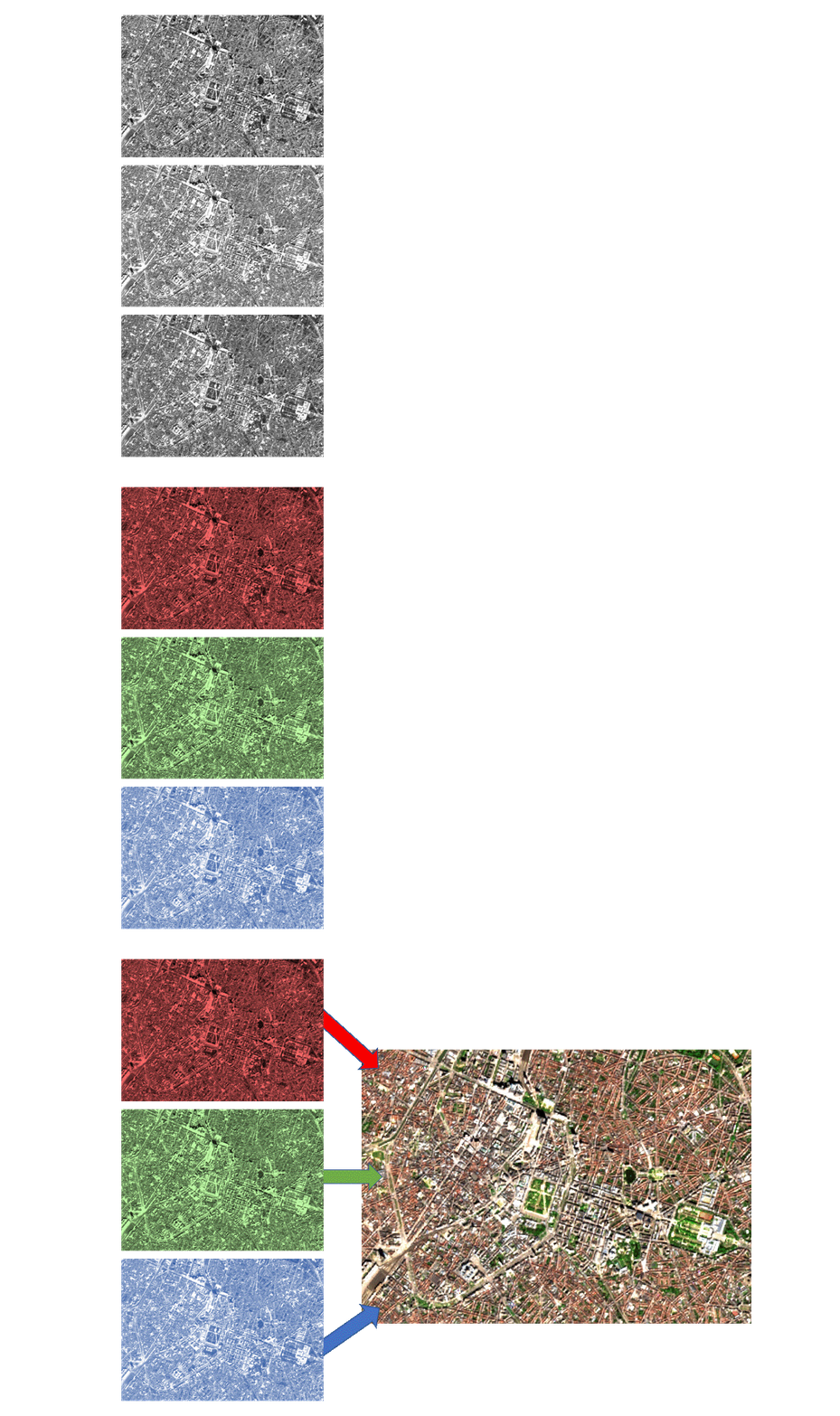 The spectral bands can be visualised by linking them to red, green and blue screen channels, as in the case of this Sentinel-2 image of Brussels taken on 27/4/2021. Source: Geospatial Lessons - Humboldt State University
Because all colours on our screen are formed using only three primary colours (blue, green and red), we can also visualise only three image channels or three spectral bands at a time. We do this by linking the screen channels (red, green, blue) each to a particular spectral band. Thus, we obtain a true colour composite by linking the red, green and blue screen colours to the red, green and blue spectral bands, respectively.
Thermal imaging is a special case. The detection of infrared energy emitted by the earth (thermal infrared, between 3 and 14 micrometres) requires a different technique from the one used to capture reflected infrared energy. Thermal infrared sensors (or thermal sensors) use photodetectors whose surfaces are sensitive to contact with infrared photons emitted by the earth. These detectors are cooled to very low temperatures (close to absolute zero) to reduce their own thermal infrared emission.
Thermal sensors actually measure the surface temperature and thermal properties of the Earth's surface. The detected radiation is calibrated using one or more internal temperature references. In this way, thermal sensors can determine the absolute temperature of the captured radiation. To analyse an image of the relative radiation temperature (a thermogram), we show it in different shades of grey. Warmer temperatures are shown in brighter shades and colder temperatures in darker ones.
 |
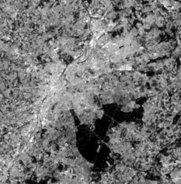 |
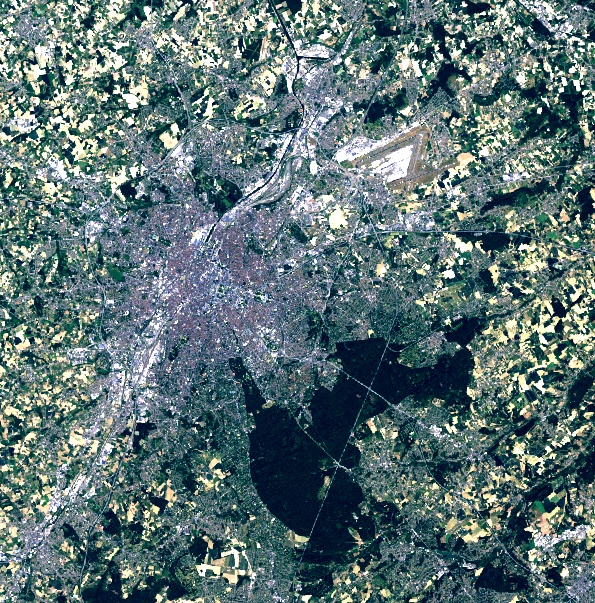
Snippet of a Landsat-8 image taken over Brussels on 28/5/2020. True colour image (left) and thermal infrared image (right). Artificial surfaces such as asphalt and concrete radiate more heat than vegetation. Therefore, urban fabric is shown brighter than water or vegetation in the image on the right. The large black spot in the south-east is part of Sonian Forest, extended by the Bois de la Cambre and Tervuren park.