III - WHAT IS A DIGITAL IMAGE?
2- CHARACTERISTICS OF AN IMAGE
2.3- Temporal resolution
Temporal resolution refers to the time it takes an earth observation satellite to return over the same location. It corresponds to a full orbital cycle and can vary greatly depending on the satellite (e.g. 26 days for Pléiades, 16 days for Landsat-8, 10 days for the Sentinel-2 satellites and daily for MODIS).
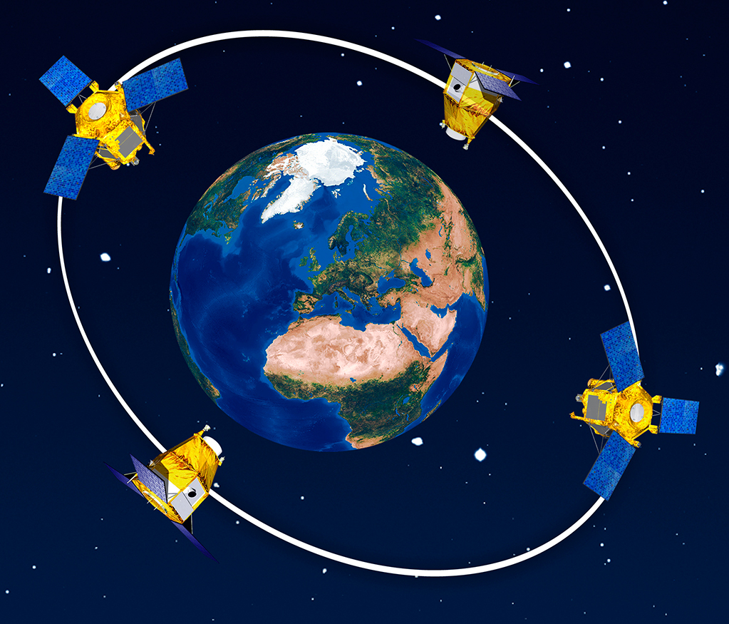
Having multiple satellites working together in the same orbit can significantly improve temporal resolution. For example, Landat-9 has been put into orbit 8 days out of phase with Landsat-8. Every area on Earth is thus observed by one of the satellites every 8 days. Similarly, both Sentinel-2 satellites are in the same orbit 180° apart and can thus observe the same place on Earth every 5 days.
The Pléiades-1A and -1B satellites form a constellation with SPOT- 6 and SPOT-7. The four satellites are located in the same orbital region, 90° apart. Artist’s view. Image credits: CNES - Airbus Defence and Space
Besides working with multiple satellites (constellations), temporal resolution can also be refined by the so-called "multi-angle" capabilities of some satellites. By changing the sensor angle dynamically instead of keeping a static nadir position (= straight down), the same area on Earth can be captured with a different angle of view. As a result, a shorter period between two observations can be achieved. In the case of Pléiades, for example, the time resolution can be up to 7 days if we are willing to accept a 20° angle of view.
In passive remote sensing, good temporal resolution increases the chances of a cloud-free acquisition, but also becomes possible to map changes over a few days or even hours, as in the case of natural disasters.

Off-nadir viewing capability of SPOT HRV, HRVIR allows a short revisit interval of 1 to 3 days possible. Source: Un regard sur la Terre - Image credits: CNES.
For radar satellites, recurrence times range from 11 to 45 days, depending on the platform.
| Satellite | Sentinel-1 | TerraSAR-X | CosmoSkyMed | RadarSAT | ALOS2 |
| Time of revisit [days] | 12 | 11 | 16 | 24 | 45 |
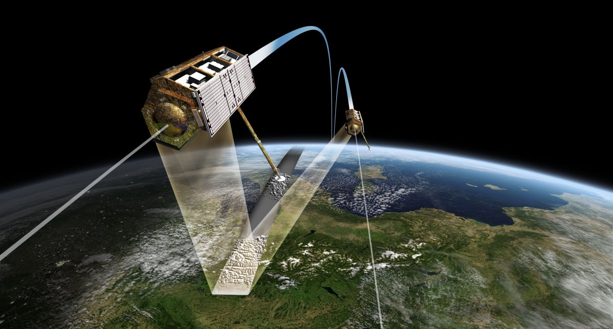
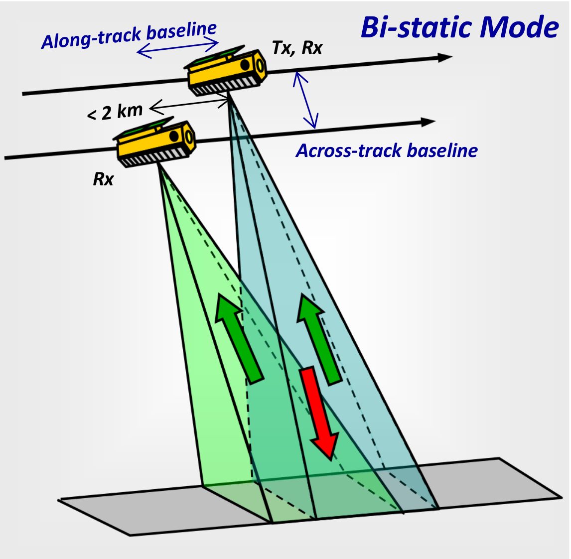
In the case of the TerraSAR-X / TanDEM-X constellation, the orbits of both satellites are adjusted to work in tandem: the two satellites fly in formation and observe the same area simultaneously with a periodicity of 11 days. The distance between the two satellites is known and varies from several kilometres to sometimes as little as 120 m.
The radar sensors can thus form a 3D image of the terrain with just one pass. We call this a bistatic interferometric system. One of the satellites sends a radar signal to Earth. The returning, scattered signal is received by both satellites.
|
Sketch of InSAR measurements configuration. Source: Technical Concept - TanDEM-X Science Server - Deutsches Zentrum für Luft- und Raumfahrt (DLR) |