

IV - FROM DATA TO INFORMATION
4- HOW CAN WE ANALYSE IMAGES AND PRODUCE MAPS?
4.3- How can an image be visually analysed?
Before digital images or computer classification procedures, only analogue aerial photographs were available. Experienced image analysts analysed these photos using tracing paper and coloured pencils. In this way, they could still derive a considerable amount of information from them.
Photographs were soon replaced by digital images, and since the development of digital image processing, interpretation techniques were implemented using powerful computers.
Compared to digital analysis, which is performed quasi-automatically by computers using increasingly sophisticated algorithms, visual interpretation is obviously a rather slow and strenuous work. Nevertheless, it continues to play an important role because it offers significant advantages. Namely, it is performed by specialists who can take into account the colour of the objects and their shape, size and texture in the visualised spectral channels. Moreover, they also take into account where the objects are relative to each other in the image. This allows them to recognise the functions of certain buildings or structures of objects: houses, industrial sites, different farming methods, transport networks,...
For example, the algorithms used for automatic image classification often confuse ground cover types that are spectrally very similar yet completely different such as roof tiles and bare soil or asphalt on roads and the roofing on some buildings.
Rapid advances in applying artificial intelligence and so-called deep learning now make it possible to use the potential of computers to perform computer-assisted photo interpretation.
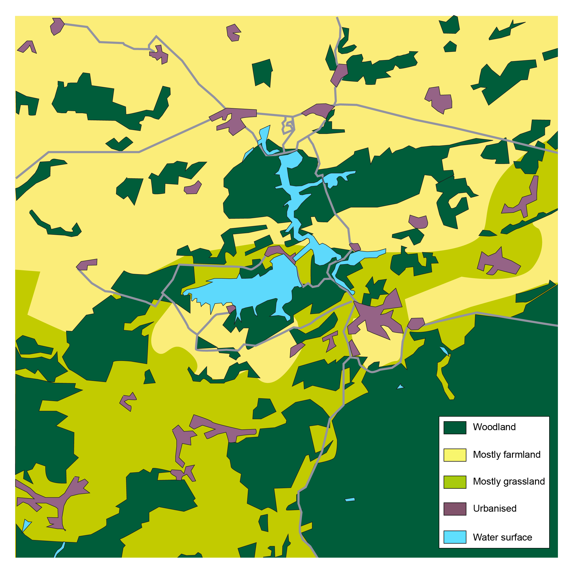
In the above map derived from an image of Eau d'Heure lakes, the definition of some land cover classes is intentionally very broad. We have distinguished the areas of the image where cultivated plots are in the majority (in yellow) from areas where grassland dominates (in light green). These results are quite different from those that would be obtained by pixel-level digital classification, but they often correspond better to users' needs. It is of course possible to combine the two approaches, for example to classify cultivated areas and forests based on digital, supervised classification and to extract built-up areas, the road network, etc. by visual interpretation.
